

In this guide 43
- What Makes Geirangerfjord a UNESCO World Heritage Site
- Best Things to Do in Geirangerfjord
- Geirangerfjord Viewpoints and Hikes
- How to Get to Geirangerfjord
- Best Time to Visit Geirangerfjord
- Geirangerfjord Costs and Where to Stay
- Sample Two Day Geirangerfjord Itinerary
- Practical Tips for Visiting Geirangerfjord
- Combine Geirangerfjord With These Nearby Destinations
- Frequently Asked Questions About Geirangerfjord
- Conclusion
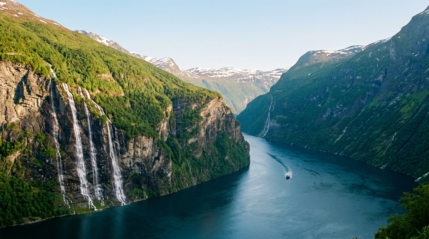
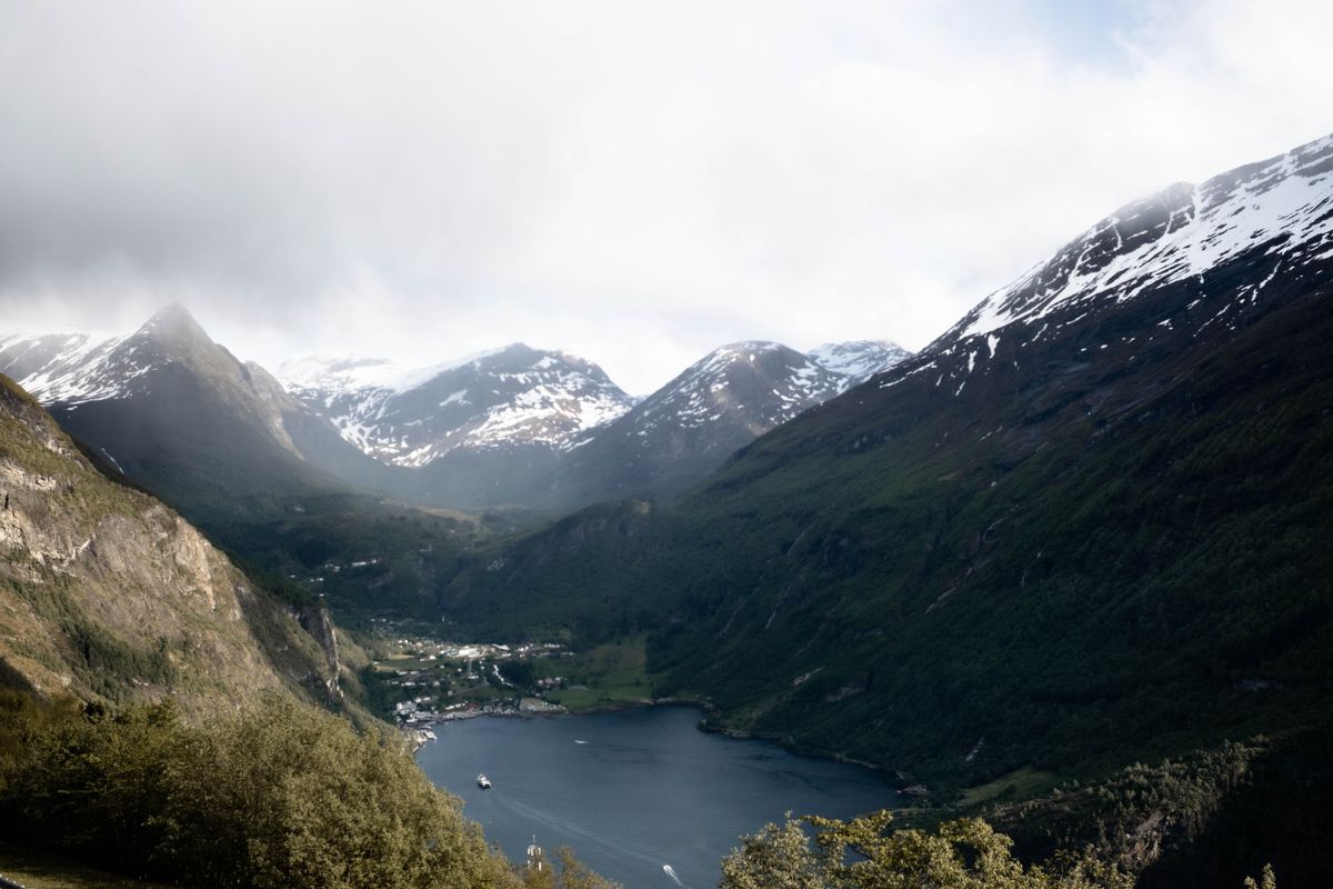
Geirangerfjord stretches 15 kilometres through Møre og Romsdal, where cliffs rise steeply from water up to 260 metres deep toward peaks of around 1,700 metres. Waterfalls tumble into the fjord from both walls, abandoned farms cling to ledges 250 metres above the surface, and the hairpins of the Eagle Road drop you into a valley that looks like it was carved yesterday. This is one of Norway’s most visited fjords, a UNESCO World Heritage site since 2005, and from May to September it is also one of the country’s busiest cruise ports.
You need to know when the ferries run, which roads close for winter, where the cruise crowds concentrate, and which hikes reward effort with solitude. This guide covers the viewpoints, the trails, the transport links, the costs, and a two-day route that strings it all together without wasting a morning queuing for a bus that left full.
Some links in this guide are affiliate links. If you book through one, Roamdusk may earn a commission at no extra cost to you. It never decides what we recommend.
What Makes Geirangerfjord a UNESCO World Heritage Site
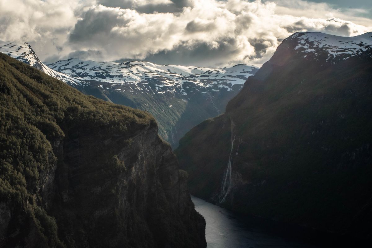
Geirangerfjord earned UNESCO World Heritage status in 2005 as part of the West Norwegian Fjords property, listed jointly with Nærøyfjord farther south. The inscription recognises exceptional natural beauty and the fjords as a classic example of a landscape carved by glaciers over successive ice ages. The fjord reaches 260 metres in depth, and the surrounding peaks rise to around 1,700 metres, creating some of the steepest relief in coastal Norway.
The fjord runs 15 kilometres from Hellesylt at the outer end to Geiranger village at the inner terminus. It forms a branch of Storfjorden, the larger fjord system that extends west to Ålesund. The cliffs display textbook examples of glacial erosion, U-shaped valleys, and hanging valleys where tributary glaciers once joined the main ice stream. Waterfalls mark those junctions, and the tallest stream of the Seven Sisters drops about 250 metres.
Best Things to Do in Geirangerfjord
Most visitors spend one or two days in Geirangerfjord, and the best activities split between water level and the viewpoints high above. The fjord itself is the main draw, but the roads and trails around it deliver perspectives you cannot get from a boat.
Geiranger to Hellesylt Ferry and Sightseeing Cruises
The Geiranger to Hellesylt car ferry is both transport and sightseeing. The crossing takes just over an hour and passes the Seven Sisters, the Suitor, and the Bridal Veil waterfalls. Two companies share the route, Fjord1 and The Fjords, so there are several departures a day in summer. Foot passengers pay from about NOK 400 and can usually just turn up, while a car with passengers costs roughly NOK 1,500 one way, and vehicles should book ahead from June to August.
Sailings run from spring to autumn, with the most departures from May to September and no service in the depth of winter. If you are driving a fjord loop, the ferry is the most scenic link between Geiranger and Hellesylt, and it saves you a long drive over the mountains. For a sightseeing-only trip, local boat operators in Geiranger run 90-minute fjord cruises that approach the waterfalls more closely than the car ferry, and some include a drop-off for the Skageflå hike.
The Seven Sisters, Suitor, and Bridal Veil Waterfalls
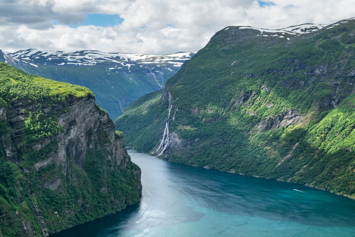
The Seven Sisters waterfall, known in Norwegian as De syv søstrene, consists of seven separate streams descending the southern wall of the fjord beside the abandoned Knivsflå farm. The tallest individual drop is about 250 metres, and the combined flow is strongest in May and June when snowmelt peaks. Opposite the Seven Sisters, below Skageflå, the Suitor waterfall splits into two channels that local legend describes as a suitor trying to woo the sisters across the fjord.
The Bridal Veil, or Brudesløret, sits farther along the fjord and is named for the way sunlight filters through its fine spray. All three are visible from the Hellesylt ferry and from sightseeing boats, but the ferry keeps a greater distance. From Geiranger village, the Skageflå hike brings you high above the Seven Sisters for a fraction of the cost of a boat tour.

Eagle Road and Ørnesvingen Viewpoint
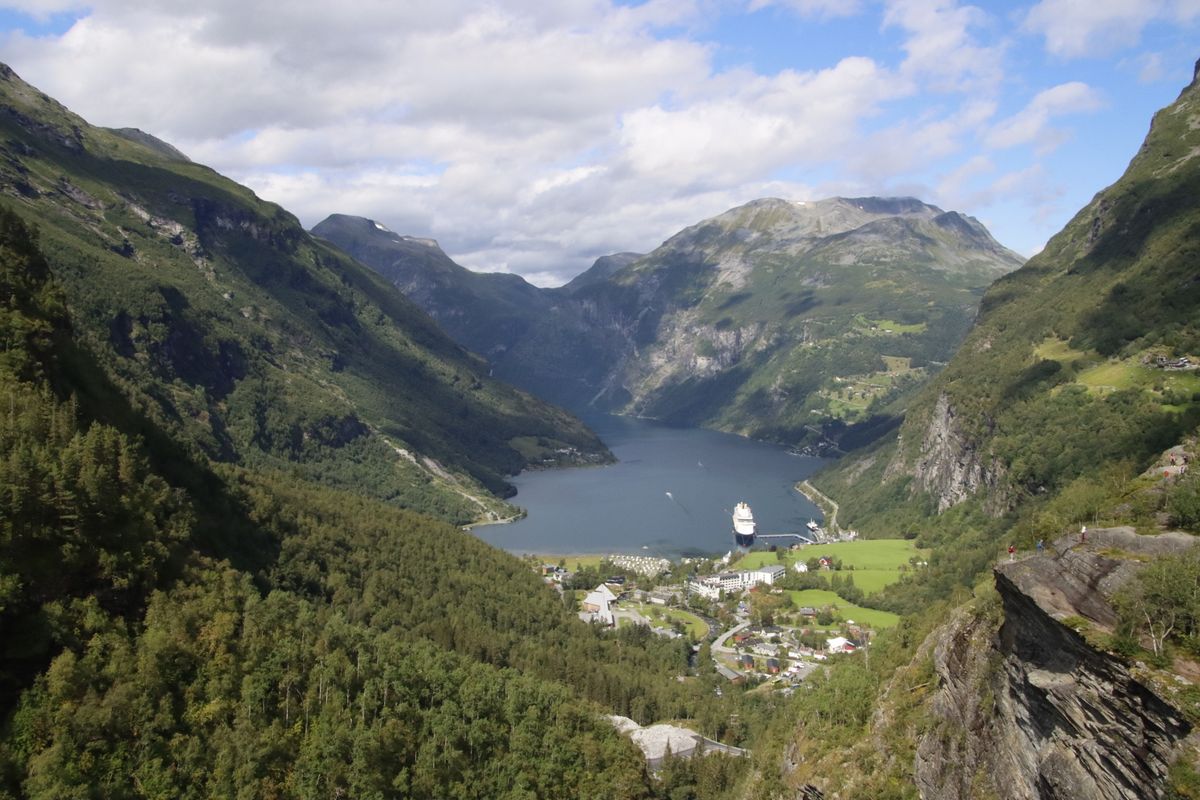
Eagle Road, or Ørnevegen, is the section of County Road 63 that climbs from Geiranger toward Eidsdal in eleven hairpin bends. The Ørnesvingen viewpoint sits near the top of the bends, about 620 metres above the fjord, and looks straight down the length of Geirangerfjord to Geiranger village and the cruise ships at anchor. The road opened in 1955 and is part of the Geiranger to Trollstigen National Tourist Route.
The viewpoint has a car park and toilets, and it is reached by car, tour bus, or bicycle. Eagle Road is Geiranger’s main road link outside summer and is normally kept open through the winter, although it can close for short periods because of snow or avalanche risk, and the viewpoint facilities close for the season. Check the Norwegian Public Roads Administration’s road status service before you drive.
From Ørnesvingen, the road continues over the pass to Eidsdal, where a short ferry crossing connects to Linge and the road toward Valldal, Trollstigen, and Åndalsnes. If you are driving a loop, Eagle Road, the Eidsdal to Linge ferry, and Trollstigen make up the classic northern fjord circuit.
Flydalsjuvet Viewpoint
Flydalsjuvet sits about 4 kilometres from Geiranger village along County Road 63, on the road south toward Dalsnibba. The viewpoint has two platforms connected by a walkway, and the view takes in the inner fjord, the village, and the cruise berths. It is the first major photo stop on the road to Dalsnibba, and most sightseeing buses pause here for 10 to 15 minutes.
The site is free, accessible by car, and has a small car park. Because it sits lower than Ørnesvingen and closer to the village, Flydalsjuvet is the easier option if you are short on time or if the high mountain road to Dalsnibba is still closed. The view is less dramatic than Dalsnibba but more intimate, and the overhanging rock beside the platform is one of the most photographed spots in Norway.
Dalsnibba and Geiranger Skywalk
Dalsnibba is a mountain summit 1,476 metres above sea level, reached by a private toll road that branches from County Road 63 about 17 kilometres from Geiranger. The Geiranger Skywalk viewing platform sits at the summit, with views straight down to Geiranger and the fjord around 1,500 metres below. The site is marketed as Europe’s highest fjord view accessible by road.
The toll road, Nibbevegen, is 5 kilometres long and costs around NOK 380 per car. It is usually open from late May or early June until October, depending on snow. Buses run from Geiranger village to Dalsnibba during the summer season. If you are driving, allow about 35 minutes from Geiranger to the summit, plus time at the viewpoint.
The view from Dalsnibba covers Geiranger, the inner fjord, and the peaks around it, with snowfields close by well into summer. On a clear day, you can see a long way across the mountains. The summit is often much colder than the village, and wind is common, so bring a jacket even in July.
Norwegian Fjord Centre
The Norwegian Fjord Centre, or Norsk Fjordsenter, is the official visitor centre for the Geirangerfjord World Heritage Area. It sits above the village centre, a short walk from the ferry pier. It is open daily, with longer hours in the May to October high season, and adult admission is roughly NOK 150, with discounts for children and families.
The exhibitions cover how glaciers formed the fjord landscape, the UNESCO World Heritage listing, the ecology of the fjord, and the history of the cliff farms. One section explains the risk posed by unstable mountainsides, such as Åkneset in neighbouring Sunnylvsfjorden, and the tsunami a large rockslide could send through the fjord. The centre also has a children’s area and a cinema.
If you are visiting on a cruise ship day or if rain closes the high viewpoints, the Fjord Centre is the best indoor alternative. The exhibitions are well produced, the English signage is comprehensive, and the visit takes about 90 minutes.
Kayaking and RIB Boat Tours
Kayaking in Geirangerfjord puts you at water level with the cliffs, the waterfalls, and the silence that disappears when a cruise ship passes. Guided kayak tours run from Geiranger village, typically lasting 2 to 3 hours and costing NOK 600 to NOK 900 per person. Most tours paddle toward the Bridal Veil or along the shore toward the Seven Sisters. No previous kayaking experience is required, and safety equipment is provided.
RIB boat tours are faster, louder, and closer to the waterfalls than the sightseeing ferries. Tours depart several times a day during the summer season, last about 1 hour, and cost NOK 700 to NOK 900. The boats carry small groups, and the ride can be rough if there is wind or boat traffic. Waterproof suits and life jackets are supplied, but you may still get wet.
Both activities run from May to September, with reduced schedules in the shoulder months. Book in advance if you are visiting in July or August, especially on cruise ship days when tours fill quickly.
Geirangerfjord Viewpoints and Hikes
The trails around Geirangerfjord range from short walks to all-day climbs, and the difficulty varies more than the distance suggests. The hikes below are the most popular, and the comparison table that follows shows what each one demands.
Fosseråsa and Storsæterfossen Waterfall
Fosseråsa is a marked trail that climbs from the centre of Geiranger beside the Geiranger river, with stairs and viewpoints over a series of waterfalls, up to Vesterås farm. From Vesterås, a well-used path continues up the valley to Storsæterfossen, a waterfall with a ledge behind the curtain of water that you can walk through. Walking the whole route from the village to the waterfall takes about 2 to 2.5 hours each way.
The paths are well maintained, with steps, boardwalks, and handrails on the steepest sections. They cross open slopes with views over the fjord, pass through birch forest, and end at Storsæterfossen. The route suits fit walkers and older children, but it is steep in places and can be slippery when wet.
Skageflå Abandoned Farm Hike
Skageflå is an abandoned cliff farm about 250 metres above Geirangerfjord, reached either by boat to Skagehola followed by a steep climb, or by hiking the full route from Geiranger over the mountain via Homlongsætra. The climb from the boat landing at Skagehola takes about 45 minutes. The full hike from Geiranger is a long day out, with several hundred metres of ascent and a steep descent to the farm.
The path from Skagehola is very steep, narrow, and exposed in places, with steps, fences, handrails, and chains protecting the most difficult sections. The hike is not suitable for people uncomfortable with heights, and it can be dangerous when wet or icy. The farm itself is a cluster of old wooden buildings and terraces, with views across to the Seven Sisters and down the length of the fjord.
Some sightseeing boats from Geiranger offer a drop-off and pick-up service at Skagehola. If you miss your return boat, the only alternative is to hike out over the mountain to Geiranger, which takes several hours and a lot of climbing. Confirm the pick-up time before you start, and keep the operator’s phone number with you.
Vesterås Farm
Vesterås is a working farm about 3 kilometres above Geiranger, reachable by car or on foot along Fosseråsa. It is the usual starting point for the walk to Storsæterfossen, which takes about 45 minutes each way from the farm on a well-marked, moderately steep path suited to most walkers.
Vesterås has a small paid car park and a café serving local food, and it is the best compromise between effort and reward if you are short on time. The trail is usable from late spring to autumn, but snow and ice make it hazardous in winter.
| Hike | Starting point | Time (one way) | Difficulty |
|---|---|---|---|
| Vesterås to Storsæterfossen | Vesterås farm | About 45 minutes | Moderate |
| Fosseråsa to Storsæterfossen | Geiranger village | 2 to 2.5 hours | Moderate |
| Skageflå (from the Skagehola boat drop) | Skagehola landing | About 45 minutes | Demanding |
| Skageflå (over the mountain) | Geiranger village | A full day return | Demanding |
How to Get to Geirangerfjord
Geiranger is not on a rail line, and the nearest major airport is Ålesund. Most visitors arrive by car, by bus from Ålesund or Åndalsnes, or by cruise ship. The roads into the valley are among the most scenic in Norway, but the high mountain roads close for winter, so timing matters.
From Ålesund Airport
Ålesund Airport (AES), at Vigra, is about 15 kilometres from Ålesund city centre and roughly 110 kilometres from Geiranger by road. An airport bus runs to the city in about 25 minutes. From Ålesund, you can take a bus, a summer boat, or a rental car to Geiranger.
The summer bus from Ålesund to Geiranger takes around 3 hours and runs only a few times a day, mostly from June to August, so check the regional FRAM timetable before you plan around it. In summer you can also reach Geiranger by boat, including on Hurtigruten coastal voyages that call at Geiranger, which turns the journey into a fjord cruise.
From Åndalsnes by Bus and Train
Åndalsnes is the nearest town with a railway station, about 85 kilometres from Geiranger by road via Trollstigen. The Rauma Railway connects Åndalsnes to Dombås, where you can change for Oslo or Trondheim. The railway is one of the most scenic in Norway, following the Romsdalen valley past the Trollveggen cliff.
From Åndalsnes, a summer sightseeing bus runs to Geiranger via Trollstigen, Valldal, and Eagle Road, with photo stops along the way. It only operates while Trollstigen is open, so it does not run in winter or spring.
Driving to Geirangerfjord
Driving to Geirangerfjord gives you the flexibility to stop at viewpoints and to visit outside the cruise ship hours. From Oslo, the drive is about 450 kilometres and takes around 7 hours without stops, via Lillehammer, Otta, and the Strynefjell mountain road, then down past Dalsnibba. From Bergen, the drive is about 380 kilometres and takes around 7 hours, including ferry crossings.
The roads are narrow, winding, and slow, especially over the mountain passes. County Road 63, which includes Trollstigen and Eagle Road, is part of a National Tourist Route, and the hairpin sections are slow going. Allow more time than a GPS estimate suggests, and check road status before you leave.
Parking in Geiranger village is paid, and it fills by mid-morning on cruise ship days. If you arrive after 10:00 in July or August, expect to park outside the centre and walk in.
Trollstigen to Geiranger Route
Trollstigen is the mountain pass on County Road 63 between Åndalsnes and Valldal, famous for its eleven hairpin bends and the viewing platforms at the top. In 2026 the road opened on 27 April, about a month earlier than usual, and it normally stays open until October or November, weather permitting. Check the road status in autumn, when maintenance work or early snow can close it.
From the Trollstigen plateau, the road descends to Valldal and continues along the fjord to Linge. From Linge, a 10-minute ferry crosses to Eidsdal, and from Eidsdal the road climbs over the pass and descends the Eagle Road to Geiranger. The full drive from Trollstigen to Geiranger takes about 90 minutes, not including stops.
The Trollstigen to Geiranger route is the classic northern fjord drive, and it is one of the most photographed roads in Norway. If you are driving it, start early to avoid tour buses and to have the viewpoints to yourself. The road is narrow, and passing is difficult when traffic is heavy.
Hellesylt Ferry Connection
The Hellesylt to Geiranger ferry is the only direct link between the two villages, and it is the route most drivers use to complete a fjord loop. The ferry takes just over an hour and passes the Seven Sisters, the Suitor, and the Bridal Veil. It is a car ferry, so you drive on and drive off.
Booking is recommended for vehicles, especially from June to August, and check-in for vehicles closes 30 minutes before departure. The route is shared by Fjord1 and The Fjords, and tickets can be bought online. A car with passengers costs roughly NOK 1,500, and foot passengers pay from about NOK 400.
If the ferry is fully booked and the mountain road is open, you can drive between Hellesylt and Geiranger via Stryn, the Strynefjell road, and Dalsnibba, about 85 kilometres and close to 2 hours. Check the ferry schedule and book a vehicle space as soon as your dates are fixed.
Best Time to Visit Geirangerfjord
The best time to visit Geirangerfjord depends on what you want to avoid. July and August deliver the warmest weather, the longest days, and the heaviest crowds. May, June, and September offer a better balance, with fewer cruise ships, open roads, and lower accommodation prices. Winter is quiet and dramatic, but most facilities close and the high mountain roads are shut.
| Month | Conditions | Crowds | Roads |
|---|---|---|---|
| January to April | Snow, short days, most businesses closed | Very low | Trollstigen and the Dalsnibba road closed; Eagle Road normally open |
| May | Cool, waterfalls at peak flow, roads opening | Low | Trollstigen and the Dalsnibba road usually open from mid to late May |
| June | Mild, long days, wildflowers, some rain | Moderate | All roads open |
| July | Warmest, busiest | Very high | All roads open |
| August | Warm, busy, waterfalls lower | High | All roads open |
| September | Cooler, autumn colours, fewer tourists | Moderate | Roads open, but early snow is possible on the high passes |
| October to December | Cold, rain, snow, most services closed | Very low | Dalsnibba road closes in October; Trollstigen usually by November |
Cruise ship arrivals peak in July, with some days seeing two or more large ships and several thousand passengers in the village. The port schedule is published online, and checking it before you book accommodation or tours is the single most useful planning step. A day with no cruise ships feels like a different destination.
From 1 January 2026, passenger ships under 10,000 gross tonnes must operate with zero emissions in Norway’s World Heritage fjords, including Geirangerfjord. Larger ships, which include most ocean cruise ships, have until 2032 to comply, so big ships still call here for now.
Geirangerfjord Costs and Where to Stay
Geiranger is expensive by European standards, as is most of Norway. Accommodation, meals, and activities cost more in July and August, and prices drop noticeably in the shoulder months. The table below shows typical costs in NOK.
| Item | Cost (NOK) |
|---|---|
| Budget hotel or guesthouse (per night, double room) | 1,200 to 1,800 |
| Mid-range hotel (per night, double room) | 1,800 to 2,800 |
| Campsite pitch (tent or campervan) | 250 to 400 |
| Supermarket meal for two (self-catered) | 200 to 300 |
| Restaurant meal for two (main course and drink) | 600 to 900 |
| Geiranger to Hellesylt ferry (car and passengers) | About 1,500 |
| Dalsnibba toll road (per car) | About 380 |
| Kayak tour (2 to 3 hours) | 600 to 900 |
| RIB boat tour (1 hour) | 700 to 900 |
| Norwegian Fjord Centre admission (adult) | About 150 |
Where to Stay: Geiranger, Hellesylt, Valldal, or Ålesund
Geiranger village has the widest choice of accommodation, from campsites to hotels, and it is the most convenient base if you are not driving. The village has a couple of grocery shops, several restaurants, and cafés, but prices are high and choice is limited. Most hotels and guesthouses are booked solid in July and August, so reserve well in advance.
Hellesylt is quieter, smaller, and cheaper than Geiranger, with a handful of places to stay, a campsite, and a few cafés. It sits at the outer end of the fjord, so the drive to the viewpoints is longer, but the ferry to Geiranger runs several times daily in summer. Hellesylt is a good choice if you want a base outside the cruise ship crowds.
Valldal is a farming village about 30 kilometres from Geiranger, including the Eidsdal to Linge ferry, located between the fjord and Trollstigen. It has a few places to stay, a campsite, and a supermarket, and it is cheaper and quieter than Geiranger. Valldal is a practical base if you are driving and want to visit both Geiranger and Trollstigen without moving accommodation.
Ålesund is the nearest city, with a full range of hotels, restaurants, and services. It is around 110 kilometres from Geiranger, so it makes a long day trip by car. Ålesund is the best base if you are flying in, if you want urban amenities, or if you are combining the fjords with Art Nouveau architecture and the Atlantic coast.
Norway’s right to roam, or allemannsretten, allows tent camping on uncultivated land for up to two nights in one place, provided you stay at least 150 metres from inhabited buildings. The rule does not apply to motorhomes or campervans, which must park only where vehicle parking is lawful. Driving off-road is prohibited, and popular areas often post camping bans. If you are camping, use a designated campsite or ask permission from the landowner.
Sample Two Day Geirangerfjord Itinerary
This itinerary assumes you are driving, that you have two full days, and that you are staying in or near Geiranger. It covers the highlights without rushing, and it avoids the cruise ship crowds by starting early and visiting the viewpoints before the tour buses arrive.
Day 1: Geiranger Village, Flydalsjuvet, and Dalsnibba Map
Geiranger Map
Start at the Norwegian Fjord Centre when it opens. Spend 90 minutes on the exhibitions, which give context for the landscape you will see later, including the section on the cliff farms that explains why Skageflå matters.
Flydalsjuvet Map
Drive to Flydalsjuvet, about 4 kilometres from the village. The viewpoint is free, and the car park is rarely full before 10:00. Spend 15 to 20 minutes at the platforms, then continue up County Road 63 toward Dalsnibba.
Dalsnibba Map
Pay the toll at the start of Nibbevegen and drive the 5 kilometres to the summit. Allow 30 minutes at the Geiranger Skywalk, and bring a jacket because the summit is cold and windy even in July.
Return to Geiranger for lunch. The village has several cafés and restaurants, but all are expensive. If you are self-catering, buy supplies at the grocery shop and eat at the waterfront or at one of the picnic areas along the road.
In the afternoon, take a kayak tour or a RIB boat tour. Both run from the village, and both give you a water-level perspective on the fjord and the waterfalls. If you prefer to stay on land, drive to Vesterås and walk to Storsæterfossen, about 90 minutes return, ending at a waterfall you can walk behind.
Day 2: Hellesylt Ferry, Trollstigen, and Eagle Road Map
Hellesylt Ferry Map
Take a morning ferry from Geiranger to Hellesylt. The crossing takes just over an hour and passes the Seven Sisters, the Suitor, and the Bridal Veil, and it is the best way to see the waterfalls. In Hellesylt, walk to the waterfall that drops through the village under the road bridge, which takes about 15 minutes.
Stranda and Valldal Map
Drive north from Hellesylt to Stranda, take the short ferry across Storfjorden to Liabygda, and continue to Valldal, known for its strawberries and cafés.
Trollstigen Map
From Valldal, drive up to the Trollstigen plateau, about 40 minutes each way, and walk out to the viewing platforms above the hairpins. The road is narrow and busy, so arrive outside the midday rush if you can.
Eagle Road Map
Return to Valldal, drive to Linge, and take the 10-minute ferry to Eidsdal. From there, the road crosses the pass and drops down the Eagle Road to Geiranger, with a stop at Ørnesvingen, which is quieter in the evening once the tour buses have gone. This loop is a full day, but it is achievable if you start early and the weather cooperates.
Practical Tips for Visiting Geirangerfjord
Geirangerfjord is remote, the weather is changeable, and services are limited outside the summer season. These tips cover the details that matter when you are actually there.
Weather and What to Pack
The weather in Geirangerfjord is unpredictable, with rain possible on any day of the year. July and August are the warmest months, with daytime temperatures typically 15 to 22 degrees Celsius. May, June, and September are cooler, and rain is more frequent. The summit of Dalsnibba is much colder than the village, and wind is common.
Pack layers, a waterproof jacket, and sturdy walking shoes. Even if you are not planning to hike, the viewpoints are exposed, and the paths can be muddy. Sunglasses and sunscreen are useful in summer, especially near snow at Dalsnibba.
Mobile Coverage and Internet
Mobile coverage in Geiranger village is good on the major Norwegian networks. Coverage drops on the mountain roads and is patchy or absent on some hiking trails. Download maps and timetables before you leave the village, and do not rely on your phone for navigation in the mountains.
Road Conditions and Live Status
Check the Norwegian Public Roads Administration’s road status service before you drive. Trollstigen and the Dalsnibba road close for winter, and mountain roads can close at short notice for snow, rockfall, or maintenance. The service has a map that shows closures and convoy driving at a glance.
Food and Groceries
Geiranger has a couple of small grocery shops, with prices higher than in larger towns. A simple lunch for two from the shop costs NOK 200 to NOK 300. Restaurants charge NOK 250 to NOK 400 for a main course, and many menus lean on burgers, pizza, and salmon.
If you are self-catering, buy supplies in Ålesund, Stranda, or Åndalsnes before you arrive. The shops in Geiranger are adequate for basics, but the range is limited. Most hotels include breakfast, which is the most economical meal of the day.
Cruise Ship Days
Check the Geiranger cruise schedule before you book accommodation or tours. On days with two or more large ships, the village and the viewpoints are significantly busier, parking fills by mid-morning, and tours fill quickly. If you are visiting independently, avoid dates with multiple ships, or plan to be out of the village between 10:00 and 15:00.
The busiest period is late June to early August, with July as the peak month. Some days have no ships at all, and those days feel like a different destination. The schedule is published online and updated regularly.

Combine Geirangerfjord With These Nearby Destinations
Geirangerfjord sits in the middle of western Norway’s fjord region, and it combines well with several other destinations. Most visitors spend three to five days in the area, linking Geiranger with one or two of the places below.
Ålesund
Ålesund is a coastal city about 110 kilometres west of Geiranger by road, famous for its Art Nouveau architecture and its setting across several islands. The town was rebuilt after a fire in 1904, and the centre is one of the most complete examples of Art Nouveau town planning in Europe. Ålesund has a full range of hotels, restaurants, and services, and it has the nearest airport to Geirangerfjord.
Allow one full day in Ålesund to walk the centre, climb the 418 steps to the Aksla viewpoint, and visit the Jugendstilsenteret Art Nouveau centre. If you have more time, take a trip to the bird cliffs on Runde or visit the Atlantic Sea Park aquarium. Ålesund is a practical base if you are flying in, and a good place to rest before or after the mountain roads.
Trollstigen and Åndalsnes
Trollstigen is the mountain pass between Valldal and Åndalsnes, famous for its eleven hairpin bends and the viewing platforms at the top. The road is part of a National Tourist Route and one of the most photographed roads in Norway. The drive from Geiranger to Trollstigen via Eagle Road, the Eidsdal to Linge ferry, and Valldal takes about 90 minutes, and the viewpoint is free.
Åndalsnes is a small town at the head of Romsdalsfjorden, with a railway station, a handful of hotels, and access to the Romsdalen valley. It is the base for hiking in the Romsdal Alps and sits below Trollveggen, Europe’s tallest vertical rock face. If you are travelling by train, Åndalsnes is the nearest station to Geiranger, and the Rauma Railway from Dombås is one of the most scenic in Norway.
Hellesylt, Stryn, and Loen
Hellesylt is the village at the outer end of Geirangerfjord, connected to Geiranger by ferry. It is quieter and cheaper than Geiranger, and it is a good base if you want to avoid the cruise ship crowds. The village has a waterfall that drops through the centre, and the walk to see it takes about 15 minutes.
Stryn and Loen are villages about 50 kilometres south of Hellesylt, on the inner arm of Nordfjord. Loen has the Loen Skylift, a cable car that climbs about 1,000 metres in five minutes to a viewpoint over the fjord and the surrounding glaciers. Stryn is the base for summer skiing on the Strynefjell mountains, and it has a wider range of accommodation and services than Loen.
If you are driving a fjord loop, the Geiranger to Hellesylt to Stryn to Loen route is a classic three-day circuit. The roads are scenic, the distances are manageable, and the villages are spaced for overnight stops. If you are planning more of Europe’s lakes and mountains, see our guides to Hallstatt in Austria, Lake Bled in Slovenia, and the Cinque Terre in Italy.
Frequently Asked Questions About Geirangerfjord
Is one day enough for Geirangerfjord?
One day is enough to see the main viewpoints and take a ferry or sightseeing cruise, but it is tight. If you are driving, you can cover Flydalsjuvet, Dalsnibba, and Ørnesvingen in a long day, with time for a short hike or a boat tour. If you are arriving by cruise ship, you will have a few hours on the ground, which is enough for one viewpoint and the village. Two days is better, because it allows you to hike, to avoid the cruise ship crowds, and to visit Trollstigen or Hellesylt.
When is the best time to visit Geirangerfjord?
The best time to visit Geirangerfjord is late May, June, or September, when the roads are open, the waterfalls are flowing, and the crowds are lighter than in July and August. May has the highest waterfall flow because of snowmelt, but the weather is cooler and some facilities are still closed. June offers long days, mild weather, and moderate crowds. September has autumn colours, fewer tourists, and a chance of early snow on the high passes. July and August are the warmest and busiest months, with the highest accommodation prices and the most cruise ships.
How do I avoid cruise ship crowds in Geiranger?
Check the Geiranger cruise schedule before you book, and avoid dates with two or more large ships. On cruise ship days, the village and the viewpoints are busiest between 10:00 and 15:00, so start early or visit in the late afternoon. If you are staying overnight, you will have the village to yourself before 09:00 and after 17:00. The shoulder months of May, June, and September have fewer cruise calls than July and August, and some days have no ships at all.
Do I need to book the Geiranger to Hellesylt ferry in advance?
If you are taking a car, yes, especially from June to August, because vehicle space is limited. Foot passengers can usually turn up shortly before departure. The route is shared by Fjord1 and The Fjords, and a car with passengers costs roughly NOK 1,500, while foot passengers pay from about NOK 400. If the ferry is full and the mountain road is open, you can drive round via Stryn and Dalsnibba in close to 2 hours.
Are the mountain roads to Geiranger open in May?
Usually from mid to late May, but not always. Trollstigen and the road over the mountain past Dalsnibba typically open between mid-May and early June, depending on snow. In 2026, Trollstigen opened on 27 April, about a month earlier than usual. The Eagle Road from Eidsdal is normally open all year, so Geiranger can still be reached by road and ferry when the high passes are closed. Check the Norwegian Public Roads Administration’s road status service before you drive.
Can I wild camp in a motorhome near Geirangerfjord?
No. Norway’s right to roam, or allemannsretten, allows tent camping on uncultivated land, but it does not apply to motorhomes or campervans. Motor vehicles must park only where vehicle parking is lawful, and driving off-road is prohibited. Many popular areas, including Geiranger, have local camping bans, and signs saying overnatting forbudt mean overnight parking is not allowed. Use a designated campsite, ask permission from the landowner, or park in a legal parking area and check for local restrictions.
Before you go, check these official pages for the latest details: official Visit Norway Geirangerfjord page and UNESCO World Heritage listing.
Conclusion
Geirangerfjord delivers everything it promises: steep cliffs, waterfalls that drop hundreds of metres into deep water, viewpoints that look like someone painted the horizon, and roads that make you check your brakes twice before you descend. The fjord is beautiful, it is accessible, and it is busy, which means timing and planning matter more here than in quieter parts of Norway.
Start early, book the ferry in advance if you are driving, check the cruise ship schedule, and give yourself two days instead of one. The viewpoints are free, the hikes are better than the boat tours, and the best hours are before 09:00 and after 17:00, when the village empties and the light turns the cliffs gold. Geirangerfjord is worth the detour, the toll roads, and the hairpin bends, but only if you see it on your terms rather than on a schedule written by a cruise line.