

In this guide 37
- Garden Route Trip Overview and Quick Route Map
- Day 1: Mossel Bay to George, Coastal Heritage and Rocky Headlands
- Day 2: Wilderness, Lagoons, Waterfalls and Coastal Forest
- Day 3: Wilderness to Knysna via Sedgefield, Estuaries and Ocean Heads
- Day 4: Knysna to Plettenberg Bay, Marine Sanctuaries and Robberg
- Day 5: Plettenberg Bay to Storms River, Thrills and Indigenous Forests
- Day 6: Tsitsikamma National Park, Dramatic Gorges and Ocean Trails
- Day 7: Storms River to Gqeberha, Departure or Safari Extension
- Essential Garden Route Travel Logistics
- Popular Garden Route Itinerary Extensions
- Frequently Asked Questions About the Garden Route
- How many days do you need for a Garden Route itinerary?
- Is driving the Garden Route safe?
- Should I drive the Garden Route from Cape Town to Gqeberha (Port Elizabeth) or the other way?
- Do I need to book accommodation and activities in advance?
- What should I pack for a Garden Route self-drive?
- Is the Garden Route suitable for families with young children?
- Conclusion
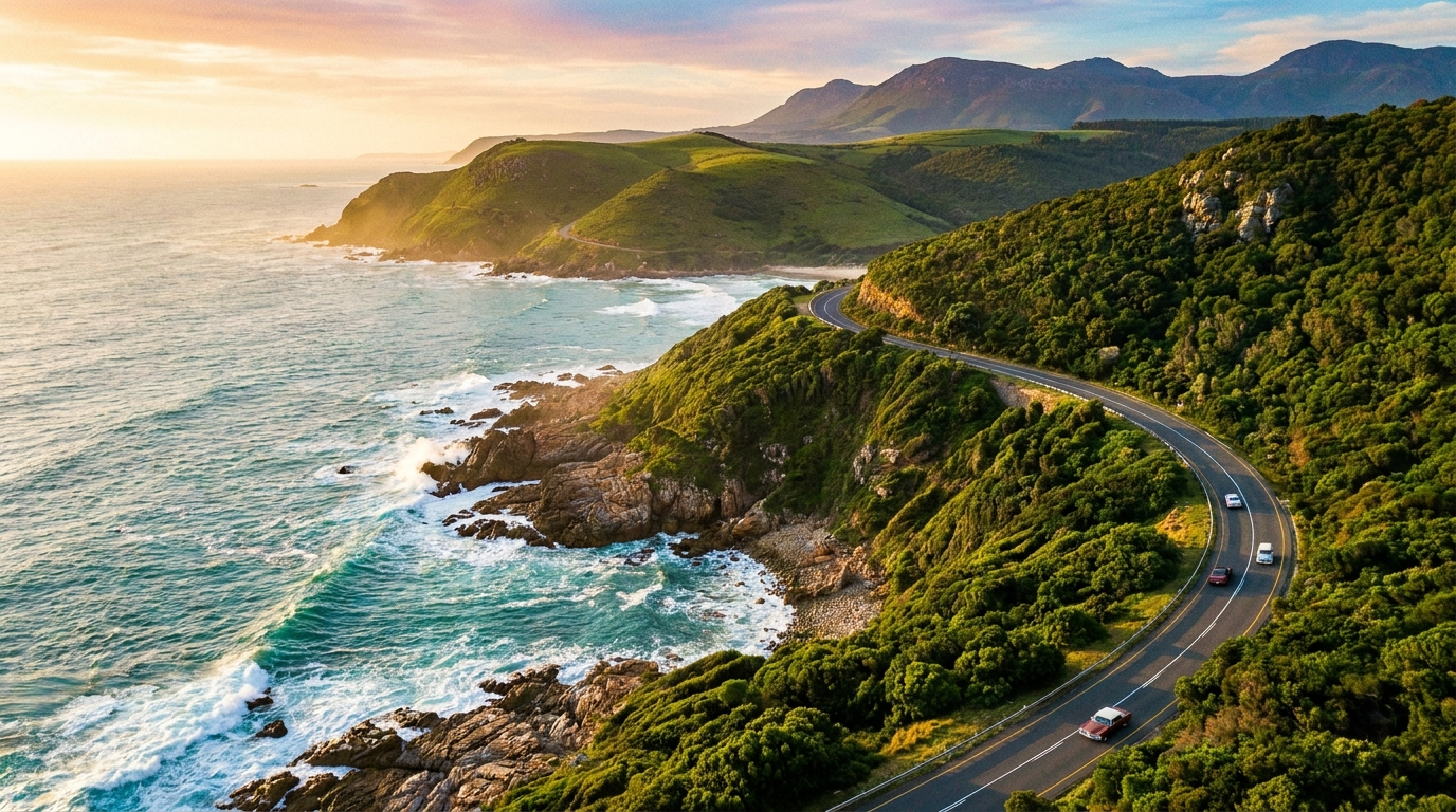
A Garden Route itinerary is the most satisfying road trip in South Africa. The drive covers about 210 km of the southern coast, from Mossel Bay through forest, lagoon and mountain scenery to the Tsitsikamma section of Garden Route National Park. Seven days is the practical minimum for the main stops, and this guide walks you through each day in order, with distances, driving times, where to sleep and what you can skip.
The N2 highway is sealed and well signed the whole way. Every town along the way has fuel stations, mobile coverage is good in towns but patchy in the Tsitsikamma forests and gorges, and most visitors drive themselves. You will pass through George, Wilderness, Sedgefield, Knysna, Plettenberg Bay and Storms River, with national park sections at Wilderness, Knysna and Tsitsikamma.
Some links in this guide are affiliate links. If you book through one, Roamdusk may earn a commission at no extra cost to you. It never decides what we recommend.
Garden Route Trip Overview and Quick Route Map
The classic Garden Route itinerary covers about 210 km from Mossel Bay to Storms River and takes three to three and a half hours of pure driving time. Add stops, hikes and meals and you need seven full days to do it properly. Most visitors start from Cape Town, which sits 440 km west of George and takes about four and a half hours. The eastern end is two hours from Gqeberha, which has the nearest major airport if you are finishing your trip there or continuing to Addo Elephant National Park.
The route follows the N2 national highway. It is a two-lane road for most of its length, with curves, mountain sections and overtaking lanes. Speed limits reach 120 km/h on open stretches, but realistic average speeds are lower because of bends, buses and town approaches. The N2 from Mossel Bay to Plettenberg Bay is toll-free. Between Plettenberg Bay and Storms River you pass the Tsitsikamma Toll Plaza near Bloukrans Bridge, which charges about R73 for a normal passenger car in 2026, so carry a card and some cash. There is no toll-free way around it: the old R102 Bloukrans Pass has been closed to traffic since flood damage in 2007.
Day 1: Mossel Bay to George, Coastal Heritage and Rocky Headlands
Morning: Cape St Blaize Lighthouse and Coastal Trail Map
Start your Garden Route itinerary at the Cape St Blaize Lighthouse, perched on the rocky headland above Mossel Bay. The lighthouse marks the western gateway to the route, and the St Blaize Trail starts just below it at the Cape St Blaize Cave, then follows the cliffs west for 13.5 km to Dana Bay. You do not need to walk it all: follow the first stretch past the lighthouse for views over the bay and the Indian Ocean, and turn back after 30 to 45 minutes. Go early to avoid the midday heat and to catch the light on the water.
The path runs close to unfenced cliff edges, so keep children close and stay on the trail. Mossel Bay has been a watering point for ships since the Portuguese explorer Bartolomeu Dias landed here in 1488. The town is not the most dramatic stop on the route, but the lighthouse walk is a good stretch after the drive from Cape Town and sets the coastal tone for the week ahead.

Afternoon: Bartolomeu Dias Museum Complex and Drive to George Map
After the lighthouse, drive back into town and visit the Bartolomeu Dias Museum Complex. The museum sits near the harbour and covers early Portuguese exploration, indigenous Khoikhoi history and the natural history of the bay. The centrepiece is a life-size replica of Dias’s caravel, which you can view but not board, because boarding is closed until further notice. Entry to the complex costs R30 for adults. Allow an hour for the museum, then have lunch at one of the harbour cafés before continuing east.
From Mossel Bay, the N2 runs inland through low hills and farmland for about 50 km to George. George is the largest town on the Garden Route and serves as the commercial hub. It has supermarkets, banks, a hospital and George Airport. The town itself holds little tourist interest, but it is a practical place to stock up on supplies or to spend the first night if you arrive late. Alternatively, continue another 15 km to Wilderness for a quieter overnight stay beside the lagoon.
Day 2: Wilderness, Lagoons, Waterfalls and Coastal Forest
Morning: Canoeing the Touw River and Half-collared Kingfisher Trail Map
Wilderness is the Garden Route’s quietest town, and the best way to see it is from the water. Rent a canoe or kayak and paddle up the Touw River, which flows through the Wilderness section of Garden Route National Park. The river is calm, shallow and lined with indigenous forest. Birdwatchers come for the half-collared kingfisher, the Knysna lourie and various herons. Canoes and kayaks can be hired in the village and at Ebb and Flow Rest Camp, and the paddle upriver to the start of the forest path takes about 40 minutes.
From the canoe landing, the Half-collared Kingfisher Trail continues on foot for about 2.5 km through the forest to a small waterfall, with boardwalks over wet sections. If you walk the whole trail from Ebb and Flow Rest Camp instead, allow 3 to 3.5 hours for the 7 to 8 km return. The trail reopened in July 2026 after storm damage, so check its status with SANParks before you go. The waterfall is modest, but the forest walk is worth it for the shade, the birdsong and the sense of being inside the vegetation rather than looking at it from a viewpoint.
Afternoon: Map of Africa Viewpoint and Wilderness Beach Map
After the river, drive up Hoekwil Road to the Map of Africa viewpoint. The viewpoint sits on the old Seven Passes Road above Wilderness and looks down on a bend in the Kaaimans River that resembles the outline of the African continent. The viewpoint is unmarked and easy to miss, so search for Map of Africa Viewpoint rather than the accommodation property of the same name. The view is best in clear light, and the stop takes ten minutes.
For the classic view over the beach, stop at Dolphin Point on the N2 at the western end of the village, which looks down on the Kaaimans River mouth and the curved railway bridge across it. Spend the rest of the afternoon on Wilderness Beach. The beach is long, wide and backed by dunes. Swimming is possible but the surf can be strong, so check conditions before you go in. The beach is free to access and has a car park at the main entrance. Walk west toward the river mouth for a quieter stretch, or stay near the car park if you want to be close to facilities. Finish the day with dinner at one of the village bistros along George Road.

Day 3: Wilderness to Knysna via Sedgefield, Estuaries and Ocean Heads
Morning: Swartvlei Beach and Gericke’s Point Map
Leave Wilderness and drive about 23 km east to Sedgefield, a small lagoon-side village that most visitors pass without stopping. Follow the signs to Swartvlei Beach, where a car park with toilets and a boardwalk leads onto the sand, then walk about 1.6 km west along the beach, 20 to 30 minutes, to Gericke’s Point, a fossil-dune headland with rock pools. The rock pools are best at low tide, when you can see anemones, starfish and small fish trapped in the shallow water. The point can be cut off at high tide, so check the tide table before you set out.
On the way from Wilderness you pass Timberlake Organic Village, which sits on the N2 between Wilderness and Sedgefield. Timberlake is a cluster of artisan food shops, a bakery, organic produce stalls and cafés, and it is a good stop for breakfast or a picnic lunch. Oysters R Us, an outdoor oyster bar, has its entrance opposite Timberlake.
Afternoon: Knysna Heads and Lagoon Boat Cruise Map
From Sedgefield, continue 25 km to Knysna. Knysna is the most developed town on the route, with a working waterfront, craft breweries, restaurants and a lagoon that opens to the sea through a narrow gap between two sandstone cliffs known as the Knysna Heads. Drive to the Heads first. The eastern head has a public viewpoint reached by a short, steep road. The western head is the private Featherbed Nature Reserve, reached only by ferry from the waterfront, and you can see it clearly from the eastern side.
The view from the Heads is the signature Garden Route shot. The gap is dramatic, the water changes colour with the tide, and the cliffs drop almost vertically into the channel. After the viewpoint, drive back to the waterfront and take a lagoon cruise if the weather is calm. Cruises leave from the Knysna Waterfront and give you a different perspective on the Heads from the water. The Knysna lagoon is also home to the endangered Knysna seahorse, though sightings are rare. Finish the day with fresh Knysna oysters at 34° South on the Knysna Quays waterfront or at Tapas and Oysters on Thesen Island.

Day 4: Knysna to Plettenberg Bay, Marine Sanctuaries and Robberg
Morning: Robberg Nature Reserve Peninsula Trail Map
Drive about 32 km from Knysna to Plettenberg Bay, then continue south to Robberg Nature Reserve. Robberg is a rocky peninsula that juts into the ocean and offers the finest coastal walk on the Garden Route. The reserve has three circular trails, all starting from the same car park: the Gap Circuit (2.1 km, about 30 minutes), the Witsand Circuit (5.5 km, about two hours) and the Point Circuit around the whole peninsula (9.2 km, about four hours). The Witsand Circuit is the best choice for half a day and includes the big sand dune that crosses the peninsula.
The car park fills quickly on weekends, holidays and summer mornings, so arrive before 9:00 if possible. Gates open at 07:00, and CapeNature lists the conservation fee at R80 for adults and R60 for children aged 4 to 17, paid at the gate. The trail is rocky, exposed and has steep sections, so wear proper shoes, carry water and bring sun protection. A colony of several thousand Cape fur seals lives on the peninsula, and you will hear them long before you see them. The trail also passes Stone Age shell middens, evidence of human occupation dating back thousands of years.
Afternoon: Lookout Beach and Seasonal Whale Watching Map
After the hike, return to Plettenberg Bay and spend the afternoon on Lookout Beach or Keurboomstrand. Lookout Beach is the main town beach, with lifeguards, parking and a boardwalk. Keurboomstrand is quieter and sits a few kilometres east, backed by the Keurbooms River lagoon. Both beaches are wide, clean and good for swimming when the surf is calm.
June to November is whale-watching season along the southern Cape coast. Southern right whales come close to shore to calve, and Plettenberg Bay is one of the best places to see them. Sightings are not guaranteed and depend on the time of year and sea conditions. Boat-based whale and dolphin cruises operate from the bay, but departures depend on weather. Book ahead and check conditions on the day. Finish with a seafood dinner at one of the coastal restaurants before settling into your Plettenberg Bay accommodation for the night.

Day 5: Plettenberg Bay to Storms River, Thrills and Indigenous Forests
Morning: Bloukrans Bridge Bungee Jump or Nature’s Valley Map
Leave Plettenberg Bay and drive east along the N2 toward Storms River, about 65 km away, and have about R73 ready for the Tsitsikamma Toll Plaza on this stretch. After about 40 km you reach Bloukrans Bridge, the site of the world’s highest commercial bridge bungee jump. The jump is 216 metres above the Bloukrans River, and jumpers must be at least 14 years old. The bridge itself is 451 metres long, with a 272-metre central span. If you are jumping, book ahead with the operator, Face Adrenalin, and allow two hours for the whole experience, including the walk out along the catwalk under the road deck and the winch recovery after the jump.
If bungee jumping is not for you, take the R102 down the Groot River Pass to Nature’s Valley instead, then return to the N2 the same way, because the old road east over the Bloukrans Pass is closed. Nature’s Valley is a small coastal settlement inside Tsitsikamma, where the Groot River meets the ocean. The lagoon walk follows the shoreline and forest around the tidal lagoon and takes one to two hours. The walk is flat, easy and good for birdwatching. The beach at Nature’s Valley is long and wild, with few facilities, so swimming is for confident swimmers only.
Afternoon: Enter Tsitsikamma and Storms River Mouth Rest Camp Map
Continue east on the N2 and enter the Tsitsikamma section of Garden Route National Park. Tsitsikamma is the most dramatic part of the route, with steep forested mountains, deep river gorges and a rocky coastline pounded by the Indian Ocean. The main visitor hub is Storms River Mouth rest camp, which sits at the end of a winding tarred access road off the N2. Check in at the camp, settle into your chalet or campsite, then walk down to the coast for your first view of the suspension bridge and the river mouth.
SANParks runs the accommodation at Storms River Mouth, and the ocean-facing chalets are the most sought-after. Book as early as possible for December, January, Easter and school holidays. SANParks accepts reservations up to 11 months ahead, and the booking window for the 11th month opens on the first working day of each month. If the rest camp is full, stay in Storms River village, which lies just off the N2 east of the river and has guesthouses, backpacker lodges and a few restaurants.
Day 6: Tsitsikamma National Park, Dramatic Gorges and Ocean Trails
Morning: Storms River Mouth Suspension Bridge Trail Map
Start the day with the Storms River Mouth suspension bridge trail. The trail is about 2 to 2.5 km return through coastal forest, and an hour is enough at an easy pace. The path is well maintained, with steps and long boardwalks. The trail ends at the suspension bridge, which is 77 metres long and crosses the river mouth. The bridge bounces as you walk, and the view into the gorge is dramatic, with cliffs dropping vertically into the dark water below.
The trail crosses three suspension bridges in all, and the main one over the river mouth is the longest. SANParks began rebuilding all three in 2026 and kept the main bridge open during the work, so check the park’s notices for closures before you go. The walk is the signature Tsitsikamma experience and is busy most mornings, so go early if you want the bridge to yourself. After the bridge, return to the rest camp and book a kayak and lilo trip through Storms River Gorge.
The trip is run by Untouched Adventures. Its price does not include the SANParks conservation fee, and wetsuit and aqua-shoe hire cost extra, but it is the only way to see the gorge from the inside. The trip lasts about two hours and involves paddling a kayak upstream, then floating back down the gorge on a lilo.
Afternoon: Tsitsikamma Waterfall Trail Map
In the afternoon, walk the first section of the Otter Trail, which day visitors know as the Waterfall Trail. The trail follows the coast west from Storms River Mouth, climbing over rocky headlands and boulder beaches. The waterfall is about 3 km from the start, so the walk is about 6 km return, and day hikers must turn back there. The full Otter Trail is a five-day hike of about 45 km to Nature’s Valley that must be booked through SANParks, but the first section is open to day visitors who have paid the park conservation fee.
The trail is rocky, exposed and can be slippery after rain. Wear shoes with grip, carry water, and check the weather before you set out. Tsitsikamma and the Outeniqua forests experience sudden downpours, even in summer, so pack a rain jacket. Return to the rest camp in the late afternoon, light a braai if your accommodation has one, and watch the sunset over the ocean. The rest camp has a small shop with basic groceries and a restaurant, but no ATM, so stock up in Plettenberg Bay and check the restaurant’s hours at reception.

Day 7: Storms River to Gqeberha, Departure or Safari Extension
Morning: Final Coastal Walk and Packing Map
On your last morning, walk back to the suspension bridge or explore one of the shorter forest trails near the rest camp. The forest is at its quietest in the early morning, and the light filtering through the canopy is best before 9:00. Pack your car, check out of the rest camp, and drive back to the N2.
From Storms River, it is about 180 km and two hours to Chief Dawid Stuurman International Airport in Gqeberha. The drive is straightforward, with fuel stations at regular intervals and no toll plazas, because the Tsitsikamma toll is paid between Plettenberg Bay and Storms River. Allow extra time if you are returning a rental car at the airport, as queues build at peak travel times.
Afternoon: Onward Travel or Addo Extension Map
If you have more time, continue from Gqeberha to Addo Elephant National Park, which sits about 70 km north of the city. Addo is a malaria-free Big Five reserve and combines naturally with the eastern end of the Garden Route. Allow two to three days for self-drive game viewing, and book your accommodation and park entry through SANParks well ahead of peak season.
Alternatively, fly out of Gqeberha in the afternoon or evening. Direct flights connect Gqeberha with Johannesburg and Cape Town, and the airport is small and easy to navigate. If you are finishing your Garden Route self-drive here, allow an hour for the car return, fuel top-up and check-in.

Essential Garden Route Travel Logistics
Best Time to Visit the Garden Route
October to April is the best general window for a Garden Route itinerary. Days are warm and beaches are swimmable, although October and November are the wettest months of the year. December and January are peak holiday months, when South African families take their summer break. Accommodation and car hire become scarce and expensive, especially around Knysna and Plettenberg Bay, so book at least four to six months ahead if you are travelling then.
May to September is quieter and often cheaper. Winter brings cold fronts and shorter daylight, but it is not the rainy season: in George and Knysna, May to July are among the driest months, and the region stays green with many pleasant days. June to November is whale-watching season along the wider southern Cape coast, and southern right whales come close to shore to calve. Sightings depend on timing and sea conditions, but Plettenberg Bay on the route and Hermanus, near Cape Town, are reliable spots. There is no universally bad month to visit, but July and August are the least reliable for beach-focused itineraries.
Car Rental, N2 Driving Rules and Road Safety
A rental car is the most practical way to follow a Garden Route itinerary. George Airport has rental desks including Avis, Europcar, First Car Rental, Hertz and Tempest, and economy cars typically cost about R350 to R850 a day before fuel, insurance and one-way drop-off fees. Book ahead for December and January, and check the one-way fee if you plan to drop the car in Gqeberha.
Drive on the left. The N2 is a two-lane highway for most of the Garden Route, with regular overtaking lanes, but it is not a freeway. Expect pedestrians, minibus taxis, slow trucks and occasional livestock near towns and on unfenced sections. Maintain a safe following distance, use overtaking lanes patiently, and avoid driving after dark where possible. Rural shoulders and hazards are poorly lit, and the section from Plettenberg Bay toward Storms River can be forested, winding and foggy, particularly in winter.
SANParks Daily Conservation Fees and Wild Card
SANParks charges a daily conservation fee for each section of Garden Route National Park you enter. From 1 November 2026 to 31 October 2027, international visitors pay R270 per adult and R136 per child aged 2 to 11 at Wilderness, R254 and R126 at Knysna, and R422 and R211 at Storms River Mouth in Tsitsikamma, or R190 and R94 at Nature’s Valley. South African and SADC visitors pay lower rates, and SANParks revises all tariffs every November.
The Wild Card is an annual pass for SANParks parks. Visitors from outside South Africa and the SADC can buy only the International All Parks Cluster card, which cost R4,680 for one person in the tariff year to 31 October 2026, so it pays off only on a long trip with many park days, such as the Garden Route combined with Addo and Kruger. You need a SANParks account to buy it, either online before you travel or at a park gate or reception that sells memberships, and it is valid for 12 months.
Popular Garden Route Itinerary Extensions
Route 62 and Oudtshoorn, Cango Caves and Klein Karoo
If you have an extra two days, detour inland from George over the Outeniqua Pass to Oudtshoorn and the Klein Karoo. Oudtshoorn sits on Route 62, a scenic back road that runs parallel to the N2 through semi-desert farmland, fruit orchards and wine estates. Oudtshoorn is famous for ostrich farms and the Cango Caves, a vast limestone cave system you can enter only on guided tours. The caves are the main draw, but the drive itself is worth it for the Swartberg Pass, a dramatic gravel mountain crossing north of Oudtshoorn that climbs to about 1,580 metres and offers views across the Karoo.
The Klein Karoo is also a strong alternative when coastal weather is poor. While the Garden Route is wet and foggy, the Klein Karoo is often dry and sunny, because the Outeniqua Mountains block the coastal rain. Allow one night in Oudtshoorn and a second in one of the Route 62 wine towns, then rejoin the N2 at George or Mossel Bay.
Addo Elephant National Park, Malaria-Free Big Five Safari
Addo Elephant National Park sits 70 km north of Gqeberha and is the natural eastern extension of a Garden Route itinerary. The park is malaria-free, self-drive friendly, and home to more than 600 elephants, plus lion, buffalo, black rhino and leopard. The park has SANParks rest camps with chalets, campsites and a restaurant, and several private lodges sit just outside the park gates.
Allow two to three days for Addo. Game viewing is best in the early morning and late afternoon, when animals come to the waterholes. The park is large, and a full loop of the main game-viewing roads takes most of a day. Book your accommodation and park entry through SANParks well ahead of school holidays and long weekends, because the rest camps fill quickly.
Frequently Asked Questions About the Garden Route
How many days do you need for a Garden Route itinerary?
Seven days is the practical minimum for the main Garden Route stops from Mossel Bay to Storms River. Four days will cover the highlights if you skip some of the shorter stops, but you will be driving most days and will have less time for hikes and beaches. Ten days is more comfortable and allows time for detours to Oudtshoorn, whale watching in Hermanus or a safari extension to Addo Elephant National Park. Most visitors find seven days hits the balance between seeing everything and not feeling rushed.
Is driving the Garden Route safe?
Yes, the Garden Route is one of the safest self-drive regions in South Africa. The N2 is well maintained and clearly signed. Fuel stations, mobile coverage and accommodation are reliable in all the main towns. Keep valuables out of sight, avoid isolated roadside stops after dark, and refuel before long stretches. Do not hike alone on remote trails, and check weather and sea conditions before heading out. Swimming and boating conditions can change quickly around river mouths and the open coast, so obey warnings and ask locals if you are unsure.
Should I drive the Garden Route from Cape Town to Gqeberha (Port Elizabeth) or the other way?
Most visitors drive west to east, from Cape Town through George to Storms River and Gqeberha. This direction puts the best scenery in the second half of the trip and finishes at Tsitsikamma, which is the most dramatic section. It also suits a one-way car rental, with pick-up in Cape Town and drop-off at Gqeberha or George Airport. Driving east to west works just as well if you are starting from Gqeberha or flying into George. The route is scenic in both directions, so choose based on your flights and onward plans rather than the direction itself.
Do I need to book accommodation and activities in advance?
Yes, for December, January, Easter and South African school holidays. Accommodation in Knysna, Plettenberg Bay and Storms River Mouth rest camp fills months ahead during peak season, and last-minute availability is rare. Book at least four to six months ahead if you are travelling then. Activities such as the Bloukrans Bridge bungee jump, kayaking at Storms River and boat cruises in Knysna also fill quickly, so book time slots as soon as your dates are fixed. Outside peak season, you can often find accommodation and activities with a few days’ notice, but booking ahead is still advisable.
What should I pack for a Garden Route self-drive?
Pack for variable weather. Even in summer, Tsitsikamma and the Outeniqua forests experience sudden downpours, so bring a rain jacket and a warm layer for cool mornings and evenings. Hiking shoes with grip are essential for Robberg, the Otter Trail and forest walks. Bring sun protection, a hat, swimwear and a towel for beaches and lagoons. A cooler box is useful for picnics and keeping drinks cold, and binoculars are worthwhile if you are interested in birdwatching or whale watching. Most accommodation has self-catering facilities, so bring basic supplies if you plan to cook.
Is the Garden Route suitable for families with young children?
Yes, the Garden Route is one of the most family-friendly regions in South Africa. The beaches are safe for paddling, the lagoons are calm, and most hikes have shorter options suitable for young children. Tsitsikamma has easy forest walks, and the suspension bridge is exciting without being scary. Many guesthouses and lodges have family rooms or self-catering cottages, and restaurants are relaxed and child-friendly. The drive itself is straightforward, with regular stops and facilities. Avoid the Robberg Point Circuit with very young children, as it is long and exposed, but the shorter Witsand Circuit is manageable for most families.
Planning more of Africa? See Things to Do in Cape Town, Fes Medina and Stone Town Zanzibar.
Before you go, check these official pages for the latest details: SANParks Garden Route National Park and CapeNature Robberg reserve information.
Conclusion
A seven-day Garden Route itinerary gives you time to see the best of South Africa’s southern coast without rushing. The route is scenic, safe and easy to drive, and every stop offers something different. Start at Mossel Bay, slow down in Wilderness, taste oysters in Knysna, hike Robberg in Plettenberg Bay, and finish with the forests and gorges of Tsitsikamma.
Book your accommodation and activities ahead for peak season, allow extra time for hikes and beaches, and drive at a pace that lets you enjoy the scenery rather than just tick off stops. The Garden Route rewards slow travel, and seven days is just enough to feel like you have seen it properly.