

In this guide 33
- How Many Days Do You Need for the Great Ocean Road?
- Day 1: Melbourne to Torquay, Anglesea and Lorne
- Day 2: Lorne to Apollo Bay and Cape Otway
- Day 3: Apollo Bay to Port Campbell
- Day 4: London Bridge, the Grotto, Bay of Martyrs and Warrnambool
- Day 5: Extend to Portland and Budj Bim, or Return Inland via Colac
- Great Ocean Road Itinerary Variations: 1-Day, 3-Day and 5-Day, Plus the Reverse Route
- Getting There: Melbourne to Twelve Apostles by Car, Train and Bus
- Great Ocean Road Costs: What to Budget
- Best Time to Visit the Great Ocean Road
- Essential Driving and Safety Tips for the Great Ocean Road
- Frequently Asked Questions About the Great Ocean Road
- Conclusion
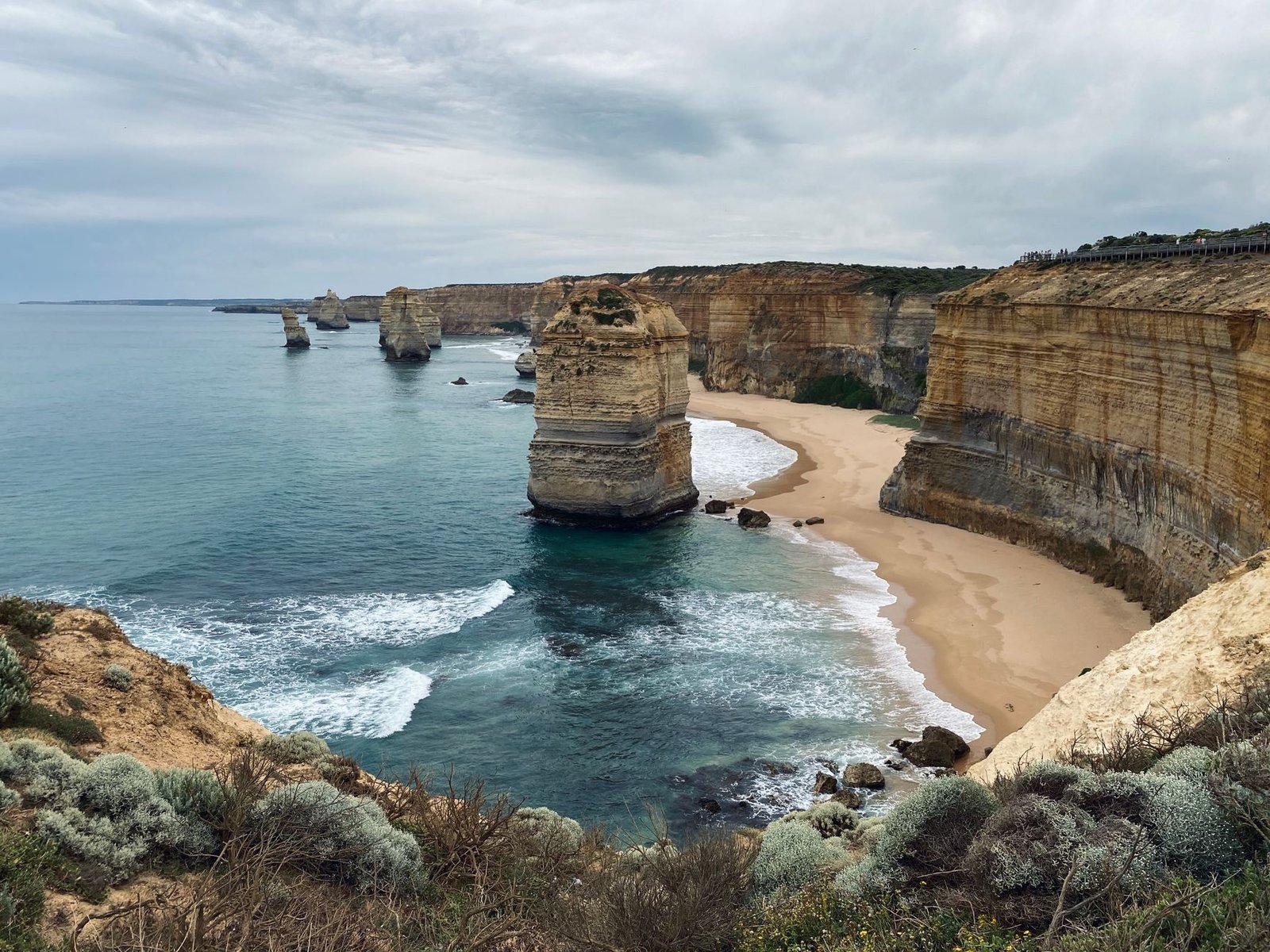
The Great Ocean Road itinerary you choose shapes the whole trip. The B100 runs 243 kilometers from Torquay to Allansford, hugging cliffs, dipping through rainforest, and meeting the Shipwreck Coast at Port Campbell National Park. Most travelers tackle it in three days, overnighting in Lorne and Apollo Bay, which gives you time to walk the Gibson Steps, watch koalas at Kennett River, and catch sunrise at the Twelve Apostles without feeling rushed.
One day is possible if you leave Melbourne before dawn and skip most detours, but you will spend more time in the car than out of it. Five days lets you add Warrnambool whale watching, the Grotto, and an inland return via Colac.
Some links in this guide are affiliate links. If you book through one, Roamdusk may earn a commission at no extra cost to you. It never decides what we recommend.
How Many Days Do You Need for the Great Ocean Road?
The answer depends on whether you want to see the Twelve Apostles or experience the drive. A one day Great Ocean Road itinerary covers Melbourne to the Twelve Apostles and back, around 500 to 550 kilometers and roughly ten hours of driving. You will stop at the main Port Campbell viewpoints and perhaps Lorne or Apollo Bay, but every stop is brief and you will skip Kennett River, Erskine Falls, and most of the rainforest. It works if your schedule is tight and you are willing to accept that the day is more about logistics than exploration.
Three days is the standard Great Ocean Road itinerary and the one this guide follows. Day one takes you from Melbourne to Lorne via Torquay and Bells Beach, with time for the Australian National Surfing Museum and a drive up to Teddy’s Lookout. Day two runs Lorne to Apollo Bay, adding Kennett River koalas, the Maits Rest boardwalk, and Cape Otway Lighthouse. Day three covers Apollo Bay to Port Campbell, where the Twelve Apostles, Gibson Steps, and Loch Ard Gorge sit within a few kilometers of each other. You sleep two nights on the coast, then either stay in Port Campbell or drive back to Melbourne inland, and you cover about 185 kilometers of the B100 between Torquay and Port Campbell, leaving room for detours and weather delays.
Five days adds Warrnambool, Tower Hill Wildlife Reserve, and the option to reverse your route or return inland via the Princes Highway through Colac. The extra time also lets you walk a section of the Great Ocean Walk from Apollo Bay, visit Hopetoun Falls and the Californian Redwoods deeper in the Great Otway National Park, and spend an afternoon at London Bridge and the Grotto west of Port Campbell. If you have five days, you can also drive the route backwards from Warrnambool to Torquay, which puts you ahead of the tour buses and gives you the Twelve Apostles in morning light instead of at the crowded end of the day.
Day 1: Melbourne to Torquay, Anglesea and Lorne
Distance: Melbourne to Lorne is about 145 kilometers. Drive time: Around 2 hours without stops. Highlights: Bells Beach, Surf City Plaza, Anglesea kangaroos, Teddy’s Lookout, Erskine Falls. Overnight base: Lorne.
Torquay: Surf City Plaza, National Surfing Museum, Bells Beach Map
Torquay marks the official start of the B100 and the beginning of the Surf Coast. The town has around 18,000 residents and an economy built on surf retail, surf schools, and road trippers heading west. Surf City Plaza on Beach Road holds big surf-brand outlets including Rip Curl and Quiksilver, and the Australian National Surfing Museum sits at 77 Beach Road inside the plaza. The museum covers the history of surfing in Australia, the Bells Beach competition, and the evolution of board design. Allow 45 minutes if you go inside.
Bells Beach is a few kilometers southwest of town, reached by a short detour off the B100. The beach is famous for the Rip Curl Pro, one of the longest-running professional surf competitions in the world, and the cliff-top viewing platforms give you a clear view of the break. The walk from the car park to the main lookout takes less than five minutes. Bells Beach is not a swimming beach because the rip and the swell make it dangerous for anyone who is not an experienced surfer. Stop for fifteen minutes, take the photo, and move on.
Anglesea: Coastal Walks and the Golf Course Kangaroos Map
Anglesea sits halfway between Torquay and Lorne, a small town with a river mouth, a patrolled beach, and a golf course where hundreds of eastern grey kangaroos graze. Visitors are no longer allowed to wander the fairways on their own, so book the Anglesea Golf Club’s guided Kangaroo Tour, a roughly 25 minute ride in an open-air electric vehicle with stops for photos. Late afternoon is usually the best time, when the mobs are out grazing.
The Surf Coast Walk runs from Torquay to Fairhaven and passes through Anglesea, with sections that follow the cliff tops and others that drop to beach level. If you have an hour, the stretch from Point Roadknight to Anglesea town gives you ocean views, coastal heath, and a good chance of seeing kangaroos in the dunes. The walk is mostly flat and the track is well marked, so it suits most fitness levels.
Lorne: Lorne Pier, Teddy’s Lookout, Erskine Falls Map
Lorne is the first overnight stop on most Great Ocean Road itineraries and the largest town between Torquay and Apollo Bay. The main street runs parallel to the beach, with cafés, galleries, and a supermarket. Lorne Pier extends into the bay and is a good spot for an evening walk, and the foreshore park has picnic tables and public toilets. The town gets busy in summer, especially over Christmas and the New Year period, but outside those weeks it is quiet enough that you can find parking near the beach.
Teddy’s Lookout is a short drive up George Street into the hills behind the town. The lookout gives you a view over the mouth of the St George River, the Great Ocean Road curving along the coast, and the ocean beyond. The road is narrow and winding, so take it slowly, and the car park at the top is small. The lookout is busiest at sunset, so if you want it to yourself, go mid-morning.
Erskine Falls is about 10 kilometers inland from Lorne, reached by Erskine Falls Road from the town. The falls drop around 30 meters into a fern-filled rainforest gully, and there are two viewing platforms. The upper platform is a short walk from the car park and gives you a clear view of the full drop.
The lower platform requires a descent of about 250 steps, which brings you to the base of the falls and the pool below. The steps are steep and the return climb takes most people fifteen to twenty minutes, so only go down if you are comfortable with that. The falls run year round but are fullest in winter and spring after rain.
Where to Stay in Lorne Map
Lorne has accommodation across most budgets, from caravan parks to boutique guesthouses. The Lorne Hotel is central and within walking distance of the beach. Budget travelers can try the Lorne Foreshore Caravan Parks, which have powered sites and cabins, though they fill quickly over summer and you need to book well ahead. Mid-range options include Mantra Lorne, which has self-contained apartments and a pool. Rooms in town sell out fast between December and February, so book early if your dates fall in that window.
Day 2: Lorne to Apollo Bay and Cape Otway
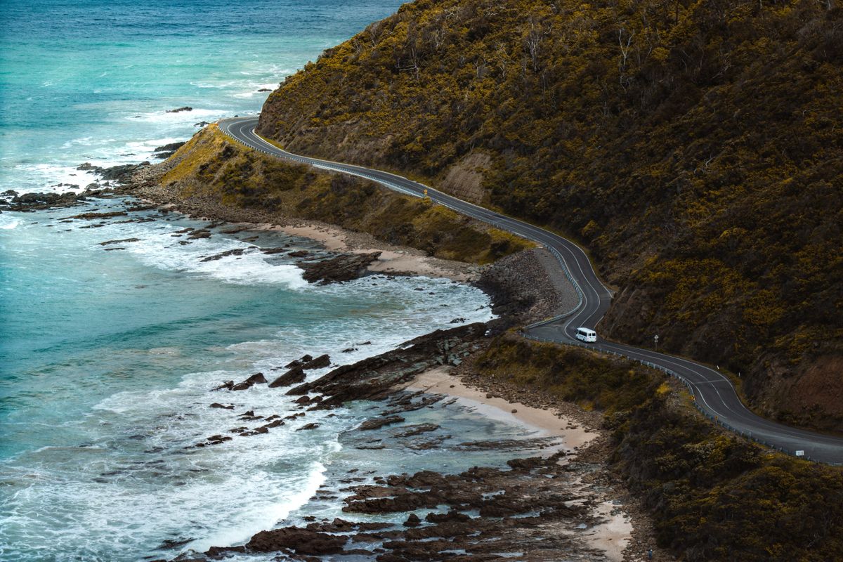
Distance: Lorne to Apollo Bay is 45 kilometers; the Cape Otway detour adds about 65 kilometers return from Apollo Bay. Drive time: About 50 minutes Lorne to Apollo Bay, plus roughly 90 minutes of driving for the Cape Otway return trip. Highlights: Kennett River koalas, Maits Rest boardwalk, Cape Otway Lighthouse. Overnight base: Apollo Bay.
Kennett River Koalas Map
Kennett River is about 23 kilometers from Lorne, roughly halfway to Apollo Bay. Turn up Grey River Road beside the caravan park and walk slowly, looking up into the manna gums. Koalas are wild here, so sightings are never guaranteed, but most visitors find at least one or two dozing in the forks of the trees within the first few hundred meters.
The koalas are used to people but they are still wild animals, so do not climb the trees, do not touch them, and do not feed them. Early morning and late afternoon give you the best light for photos, and the road is quiet enough that you can walk it without worrying about traffic.
Apollo Bay Harbour and Beach Map
Apollo Bay is a working fishing town at the foot of the Otway Ranges, with fewer than 2,000 permanent residents. The harbour sits at the northern end of the beach, and the local fleet brings in crayfish and other seafood. The foreshore has a long stretch of sand that is patrolled in summer, and the water is cold, from about 13 degrees Celsius in winter to around 18 degrees in late summer, so most visitors paddle rather than swim. The main street has cafés, fish and chip shops, and a supermarket, so it is an easy place to stop for lunch.
Apollo Bay is the last town with a full choice of fuel before the road heads inland through the Great Otway National Park. Lavers Hill, about 48 kilometers west, has the only fuel bowsers between Apollo Bay and Port Campbell, so fill the tank in Apollo Bay, and check your fuel level before the Cape Otway detour because Lighthouse Road is narrow, winding, and has no services.
Great Otway National Park and Maits Rest Rainforest Walk Map
West of Apollo Bay the B100 turns inland and climbs into the Great Otway National Park, a mix of cool temperate rainforest, eucalypt forest, and fern gullies. Maits Rest is the most accessible rainforest walk, an 800 meter boardwalk loop through ancient myrtle beech and tree ferns. The loop takes about twenty to thirty minutes and has some steps, so it is short enough that you can do it even if you are running behind schedule, and the forest is dense enough that it feels like a different world from the coast.
Cape Otway Lighthouse and Koala Spotting Map
Cape Otway Lightstation is the oldest surviving lighthouse on mainland Australia, built in 1848 and known as the Beacon of Hope for ships arriving from Europe. It sits at the end of Lighthouse Road, about 12 kilometers south of the B100 and roughly 30 kilometers from Apollo Bay. The lightstation precinct includes the lighthouse, an 1859 telegraph station, a World War II radar bunker, a whale interpretation centre, and a café.
The lightstation is open daily from 9:30am to 5pm, with last entry at 4:30pm. The lighthouse tower is closed for heritage restoration with no confirmed reopening date, so entry is discounted while the grounds and other buildings stay open: about AUD 11 for adults, AUD 5 for children aged 5 to 16, and AUD 28 for a family. Check the lightstation’s website before you go, because prices rise once the tower reopens.
Lighthouse Road passes through koala habitat, and you will often see them in the roadside eucalypts. Drive slowly, because koalas and other wildlife cross the road and they move slowly enough that you can hit one if you are not paying attention. The lightstation grounds have walking trails and picnic spots, and the cliffs look out over the point where Bass Strait meets the Southern Ocean. Allow at least an hour for the visit, plus the drive back to the B100. If you are short on time on day two, you can visit Cape Otway on the morning of day three instead, since it sits on the way west.

Where to Stay in Apollo Bay Map
Apollo Bay has fewer accommodation options than Lorne but enough variety that you can find something in most price ranges. Motels along the Great Ocean Road through town, such as the Apollo Bay Waterfront Motor Inn, are within walking distance of the beach and the main street. Budget travelers can try BIG4 Apollo Bay Pisces Holiday Park, which has cabins and powered sites close to the foreshore.
The town fills up over summer, Easter, and long weekends, so book ahead if your dates fall in those windows. Guesthouses and self-contained cottages sit on the hills behind the town and offer views over the bay, though you will need a car to reach them.
Day 3: Apollo Bay to Port Campbell
Distance: About 95 kilometers. Drive time: Roughly 1 hour 30 minutes without stops. Highlights: Gibson Steps, Twelve Apostles, Loch Ard Gorge. Overnight base: Port Campbell, or drive back to Melbourne inland in about 3 hours.
Gibson Steps and Twelve Apostles Map
The Gibson Steps are just east of the Twelve Apostles and one of the few places along this stretch where you can descend to the beach. The 86 steps were first cut into the cliff by the Kirrae Whurrong people and are named after Hugh Gibson, the settler who built the nearby Glenample Homestead in the late 1860s. They lead to a beach with two limestone stacks, known as Gog and Magog, standing just offshore.
The beach is subject to tides and wave conditions, so the steps may be closed if the swell is too large or the beach is unsafe. Check the signage at the top before you descend, and do not go down if the steps are closed. The walk from the car park to the top of the steps takes less than five minutes.
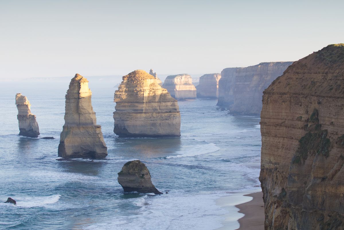
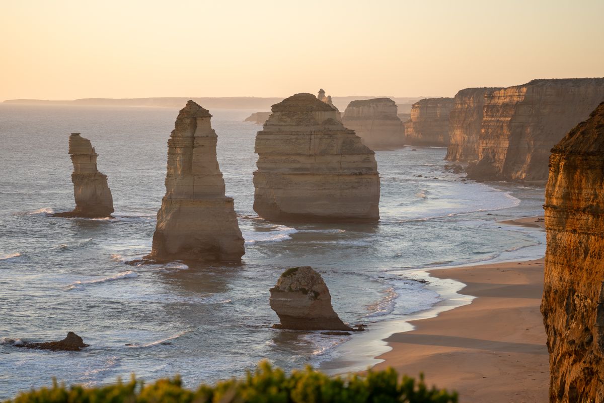
The Twelve Apostles are the most photographed landmark on any Great Ocean Road itinerary and the reason most people make the drive from Melbourne. The name is misleading because there were never twelve stacks, and erosion has reduced the number to seven or eight depending on how you count them. The stacks sit just offshore in Port Campbell National Park, and the main viewing platforms are a short walk from the car park along a paved path. The site is being rebuilt, with a new visitor centre, café, and kiosk due to open in October 2026, so expect some changes to parking and paths.
Sunrise is the quietest time, with soft light and few people on the platforms. Sunset is the busiest time, with tour buses arriving from Melbourne in the late afternoon, but the stacks glow gold in the evening light and it is the classic photo. If you stay in Port Campbell, you can do both. The main viewing platforms are accessible by wheelchair and take about five minutes to reach from the car park.
Loch Ard Gorge Map
Loch Ard Gorge is a few minutes west of the Twelve Apostles by car and named after the clipper ship Loch Ard, which ran aground nearby in 1878. Only two of the 54 people on board survived, Tom Pearce and Eva Carmichael, and the gorge and several nearby landmarks are named after the ship and the survivors. The gorge is a sheltered inlet with high limestone cliffs on three sides and a narrow entrance to the ocean. The beach at the base of the gorge is reached by a stairway from the car park.
Several short walking tracks start from the car park and lead to the gorge, the Razorback, Thunder Cave, the Mutton Bird Island lookout, and the Loch Ard cemetery. Allow about an hour to see most of them. The tracks are well marked and the surfaces are mostly boardwalk and compacted gravel, so they suit most fitness levels. The gorge is less crowded than the Twelve Apostles, and the high cliffs and narrow entrance make it feel more enclosed and dramatic. If you have time for only one stop beyond the Twelve Apostles, make it Loch Ard Gorge.
Where to Stay in Port Campbell Map
Port Campbell is a small town of a few hundred permanent residents, and accommodation options are limited. The Port Campbell Hotel and Port Campbell Parkview Motel and Apartments are both central and within walking distance of the beach. The town has a general store, a bakery, a few cafés, and a 24-hour fuel station, and the foreshore has picnic tables and public toilets.
Budget travelers can try the Port Campbell Holiday Park, which has powered sites and cabins, though it fills quickly in summer. The town is the closest overnight base to the Twelve Apostles, which makes it the best choice if you want to catch sunrise without leaving your accommodation before dawn.
Day 4: London Bridge, the Grotto, Bay of Martyrs and Warrnambool
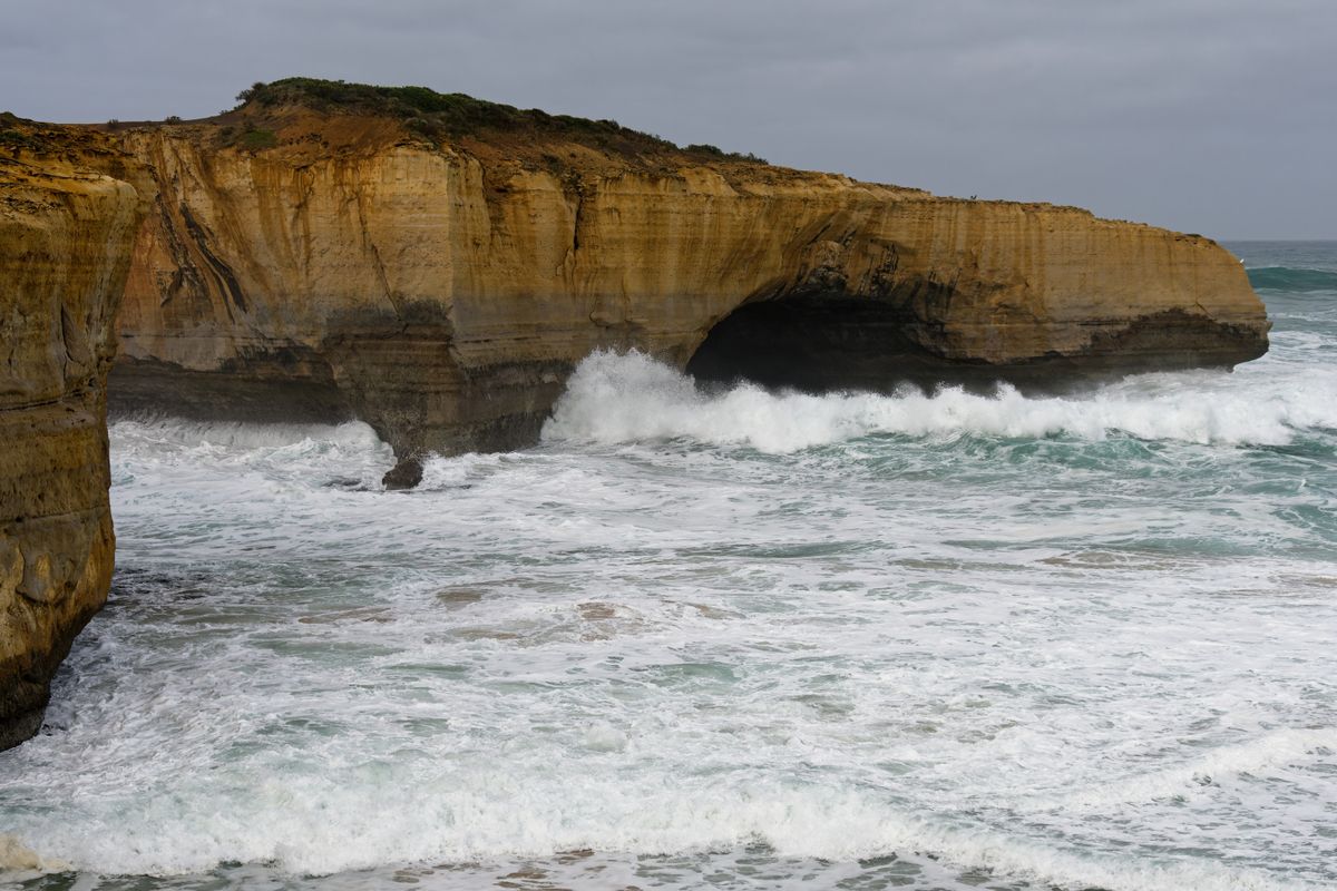
If you have a fourth day, continue west from Port Campbell to see the remaining coastal landmarks and reach Warrnambool, the largest town on the western Great Ocean Road. London Bridge, now officially called London Arch, is a coastal rock arch a few kilometers west of Port Campbell. The span linking it to the mainland collapsed in January 1990, leaving two tourists stranded on the offshore section until they were rescued by helicopter. The arch is visible from the car park lookout, and the walk from the car park takes less than five minutes.
The Grotto is a natural sinkhole and arch, reached by a short stairway from the car park. The sinkhole opens to the ocean through a narrow window, and on calm days the rock pool inside reflects the sea beyond. The site is small, and the lower viewing platform looks out through the arch to the waves. Further west, near Peterborough, the Bay of Martyrs and the Bay of Islands have quieter lookouts over dozens of smaller stacks and are rarely busy.
Logan’s Beach Whale Watching Map
Warrnambool is about 65 kilometers west of Port Campbell and the main commercial center for the western Great Ocean Road. The city has about 35,000 residents, and the main attraction for visitors is Logan’s Beach, a nursery where southern right whales come to calve. The whales generally visit between June and September, with the best chance of sightings in July and August. Sightings are never guaranteed, and the whales do not appear every day, so check the latest whale sightings on the Visit Warrnambool website before you make the detour.
The viewing platform at Logan’s Beach is free and open year round, and it sits on the dunes overlooking the bay. The platform has interpretive signs explaining the whales’ migration patterns and life cycle, and there is a car park at the site. If the whales are present, you may see them breaching, tail-slapping, and nursing calves close to shore. Bring binoculars if you have them, because the whales can be several hundred meters offshore, and dress warmly because the wind off the Southern Ocean is cold in winter.
Tower Hill Wildlife Reserve Map
Tower Hill Wildlife Reserve is about 15 kilometers west of Warrnambool, inside the crater of an extinct volcano that erupted around 35,000 years ago. The reserve is home to emus, koalas, kangaroos, and a wide variety of birdlife, and the crater floor is filled by a lake dotted with small islands. Several short walking tracks start from the visitor area, including a climb to a lookout over the crater.
Emus and kangaroos are often visible near the picnic area, and koalas are common in the eucalypts. The reserve is free to enter. It is busiest on weekends and public holidays, but even then it is quiet compared to the Twelve Apostles. If you are interested in wildlife and you have the time, Tower Hill is worth the detour.
Day 5: Extend to Portland and Budj Bim, or Return Inland via Colac
If you have a fifth day, you can continue west to Portland, the oldest European settlement in Victoria, or turn inland and return to Melbourne via Colac and the Princes Highway. Portland is about 100 kilometers west of Warrnambool and sits on Portland Bay, a deep-water port that handles grain exports and fishing.
The town has a maritime discovery centre, historic bluestone buildings from the 1840s and 1850s, and Cape Nelson Lighthouse just outside town. Portland is also the gateway to the Budj Bim Cultural Landscape, a UNESCO World Heritage site that protects the eel traps and channels built by the Gunditjmara people more than 6,000 years ago.
The inland return route via Colac is faster than retracing the B100 and gives you a different perspective on the region. From Warrnambool, take the Princes Highway east through Camperdown and Colac, then continue to Geelong and Melbourne. The route is about 260 kilometers and takes roughly three hours without stops. Colac is a farming town on the edge of the volcanic plains, and the Colac Botanic Gardens are worth a stop if you have time. The route is mostly straight and flat, so it is less scenic than the coast but easier to drive, especially if you are tired after four days on winding roads.

Great Ocean Road Itinerary Variations: 1-Day, 3-Day and 5-Day, Plus the Reverse Route
The fastest one day plan leaves Melbourne by 7am and takes the inland highway through Colac to reach the Twelve Apostles around late morning, with time for the Gibson Steps and Loch Ard Gorge before driving home along the coast. You will stop briefly at Apollo Bay and Lorne for fuel and food, but you will skip Kennett River, Erskine Falls, and Cape Otway. The coastal return reaches Melbourne in the evening, making it a very long day with most of the time spent in the car. This option suits travelers with only one free day, but it is tiring and you will see the highlights without experiencing the drive.
The three day option is the standard Great Ocean Road self-drive itinerary and the one most visitors choose. Day one covers Melbourne to Lorne via Torquay, day two runs Lorne to Apollo Bay with detours to Kennett River and Cape Otway, and day three finishes at Port Campbell with the Twelve Apostles and Loch Ard Gorge. You drive about 185 kilometers along the B100 from Torquay, which leaves time for detours, walks, and weather delays. This option balances coverage and comfort, and it is the best choice if you want to see the main landmarks without rushing.
The five day option adds Warrnambool, Portland, and the option to return inland via Colac. It also gives you time for longer walks, including the Hopetoun Falls and Californian Redwoods detour deeper in the Great Otway National Park, and the chance to drive the route in reverse from Warrnambool to Torquay.
The reverse route puts you ahead of the tour buses and gives you the Twelve Apostles in morning light, which is quieter. If you have five days, start in Melbourne, drive to Warrnambool on day one via the inland Princes Highway, then drive the B100 east to Torquay over the next three days, finishing in Melbourne on day five.
Getting There: Melbourne to Twelve Apostles by Car, Train and Bus
Most visitors drive the Great Ocean Road itinerary in a hire car, which gives you the freedom to stop where you want and travel at your own pace. Book a hire car before you leave, especially if your dates fall in summer, because availability is limited and prices rise closer to departure. Melbourne has two airports: Melbourne Airport, also called Tullamarine, is about 23 kilometers north of the city center, and Avalon Airport is about 55 kilometers southwest, closer to Geelong. Most international and domestic flights use Melbourne Airport, and the drive from the airport to Torquay takes around 90 minutes.
Public transport is possible but slow. V/Line trains run from Melbourne’s Southern Cross Station to Geelong, where you connect with a V/Line coach to Torquay, Anglesea, Lorne, and Apollo Bay. The train takes about an hour to Geelong, and the coach from Geelong to Apollo Bay takes another two and a half hours. Coaches run a few times a day, and the coach west of Apollo Bay to Warrnambool runs only on some days of the week, so check the V/Line website for current schedules before you plan around it.
The drive from Melbourne to Torquay is about 100 kilometers and takes roughly 75 to 90 minutes without traffic. From Torquay to Lorne is about 50 kilometers and 50 minutes, Lorne to Apollo Bay is another 45 kilometers and 50 minutes, and Apollo Bay to the Twelve Apostles is about 90 kilometers and 90 minutes. The total distance from Melbourne to the Twelve Apostles along the coast is roughly 275 kilometers, and the drive takes about four and a half hours without stops. Add at least two hours for stops, fuel, and food, and more if you detour to Cape Otway or Kennett River.
Great Ocean Road Costs: What to Budget
The Great Ocean Road itself is free to drive, and most of the viewpoints, beaches, and walking tracks are free to access. Cape Otway Lightstation charges around AUD 11 per adult while its tower is closed for restoration. Parking at the Twelve Apostles, Gibson Steps, and Loch Ard Gorge is free, and the sites are managed by the Great Ocean Road Coast and Parks Authority. Fuel is more expensive along the coast than in Melbourne, so fill the tank in Geelong or Torquay before you start, and refuel in Apollo Bay or Port Campbell rather than waiting until you run low.
Accommodation costs vary widely depending on the season and the town. Budget travelers can expect to pay around 40 to 70 Australian dollars per night for a powered campsite or a bed in a hostel dorm. Mid-range hotels and motels cost around 150 to 250 dollars per night for a double room, and prices rise sharply over summer and long weekends.
Food costs are similar to Melbourne, with a café breakfast around 20 to 30 dollars, a pub lunch around 25 to 35 dollars, and a restaurant main course around 35 to 50 dollars per person. Supermarkets in Lorne and Apollo Bay stock the basics, so you can save money by self-catering if your accommodation has a kitchen.
Best Time to Visit the Great Ocean Road
The best time to visit is autumn, especially March to May, when the weather is mild, the roads are quieter, and accommodation is easier to find. Daytime temperatures in autumn range from about 15 to 22 degrees Celsius, and the weather is usually more settled than in winter or spring. The low-angle light in autumn is also good for photography. Spring, from September to November, is the second-best choice, with wildflowers, full waterfalls, and fewer crowds than summer.
Summer, from December to February, is the busiest season, with daytime temperatures between 20 and 30 degrees Celsius and long daylight hours. The beaches are at their best, but the car parks fill early, accommodation is expensive, and the roads are crowded with tour buses and holiday traffic. If you visit in summer, book accommodation and hire cars well ahead, and plan to reach the Twelve Apostles before 9am to avoid the worst of the crowds. Sea fog can roll in on summer mornings near the Twelve Apostles, so check the weather forecast before you leave.
Winter, from June to August, is the quietest season, with daytime temperatures between about 7 and 14 degrees Celsius and frequent rain. The waterfalls are at their fullest, the seas are dramatic, and you will have the viewpoints almost to yourself. Winter is also the best time for whale watching at Logan’s Beach, with southern right whales visiting between June and September. The main drawback is the weather, which is cold, windy, and changeable, so pack waterproof and windproof layers and allow extra time for rain delays.
Essential Driving and Safety Tips for the Great Ocean Road
Australia drives on the left, and the B100 is a two-lane road for most of its length, with one lane in each direction. The road is winding and narrow in places, especially between Lorne and Apollo Bay, and the speed limit is usually 80 or 100 kilometers per hour, dropping to 50 or 60 in towns. Overtaking is difficult and often unsafe, so settle into the pace and do not rush. If you are driving slowly and a queue forms behind you, pull over at the next safe spot and let faster traffic pass.
Fuel stations are limited along the route, so fill the tank in Torquay, Lorne, Apollo Bay, or Port Campbell rather than waiting until you are low. Between Apollo Bay and Port Campbell, about 95 kilometers, the only fuel is at Lavers Hill, and west of Port Campbell the next full-service town is Warrnambool, about 65 kilometers away. Mobile coverage is patchy between Lorne and Port Campbell, so download offline maps before you leave Melbourne and tell someone your route and expected arrival times.
Wildlife is active at dawn and dusk, and kangaroos, koalas, and wombats cross the road without warning. Drive slowly in the early morning and late afternoon, especially on the inland sections through the Great Otway National Park, and if you see an animal on the roadside, slow down and assume it will jump in front of you. If you hit an animal, stop only where it is safe and call Wildlife Victoria’s emergency line on 03 8400 7300. Do not approach an injured kangaroo because they can kick hard enough to cause serious injury.
Beaches along the Great Ocean Road are beautiful but dangerous. The Southern Ocean has strong rips, cold water, and large waves, and many beaches are unpatrolled. Only swim at patrolled beaches, swim between the red and yellow flags, and never swim alone. If you are caught in a rip, do not swim against it. Swim parallel to the beach until you are out of the current, then swim back to shore. If you cannot make it back, raise your arm and call for help.
Frequently Asked Questions About the Great Ocean Road
How many days should you spend on the Great Ocean Road?
Three days is the standard Great Ocean Road itinerary, with two nights in Lorne and Apollo Bay. One day is possible if you leave Melbourne before dawn and skip most detours, but you will spend more time driving than exploring. Five days adds Warrnambool, the Grotto, and the option to return inland via Colac or drive the route in reverse from Warrnambool to Torquay.
What is the best direction to drive the Great Ocean Road?
Most visitors drive west from Torquay to Port Campbell or Warrnambool, which keeps the ocean on your left, the same side of the road as most lookouts, so pulling in is easier. Driving east from Warrnambool to Torquay puts you ahead of the tour buses and gives you the Twelve Apostles in morning light, which is quieter. The reverse route works best if you have five days and you can drive the inland Princes Highway from Melbourne to Warrnambool on day one.
Can you do the Great Ocean Road without a car?
Yes, but it is slow and limits your flexibility. V/Line trains run from Melbourne to Geelong, where you connect with a coach to Torquay, Lorne, and Apollo Bay, with fewer services further west to Warrnambool. The coach stops at the main towns but not at most viewpoints, so you will miss Kennett River, Erskine Falls, and many of the smaller coastal landmarks. Guided day tours from Melbourne cover the Twelve Apostles and the main stops, but they are long days and you have no control over the schedule.
Is one day enough for the Great Ocean Road?
One day covers Melbourne to the Twelve Apostles and back, around 500 to 550 kilometers and about ten hours of driving. You will see the main landmarks but you will skip most detours and you will spend more time in the car than out of it. If you only have one day, consider a guided tour so someone else does the driving, or focus on the Surf Coast between Torquay and Lorne and save the Twelve Apostles for a longer Great Ocean Road itinerary.
Where should I stay on the Great Ocean Road?
Lorne and Apollo Bay are the best overnight bases for a three day Great Ocean Road itinerary. Lorne is the largest town between Torquay and Apollo Bay, with good accommodation, cafés, and a supermarket. Apollo Bay is smaller and quieter, and it is the closest town to Cape Otway and the Great Otway National Park. Port Campbell is the best base if you want to catch sunrise at the Twelve Apostles without leaving your accommodation before dawn.
When is the best time to visit the Twelve Apostles?
Sunrise is the quietest time, with soft light and empty platforms. Sunset is the busiest and most photographed time, when tour buses arrive from Melbourne and the stacks glow gold. If you can, stay in Port Campbell and see both. Sea fog can roll in on summer mornings, so check the weather forecast before you leave.
Planning more of Oceania? See our Kaikoura seal colony guide in New Zealand, or browse all our Oceania guides.
Before you go, check the latest details on the official Great Ocean Road self-drive itineraries and the Great Ocean Road Authority’s Twelve Apostles page.
Conclusion
A Great Ocean Road itinerary gives you one of the world’s best coastal drives, from the surf breaks at Torquay to the limestone stacks at the Twelve Apostles. Three days is enough to see the main landmarks without rushing, and five days adds Warrnambool, the Grotto, and the option to drive the route in reverse. Download offline maps before you leave, book accommodation ahead if your dates fall in summer, and allow time for detours to Kennett River, Erskine Falls, and Cape Otway. The road is winding and the weather can change quickly, so drive slowly, check fuel levels, and watch for wildlife at dawn and dusk.